3D Laser Scanning For Plants
Reality Capture for Industrial Facilities, Process Plants, and Refineries
Plant Scanning Services
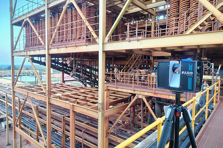
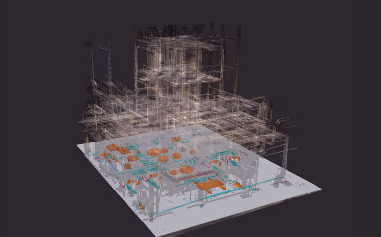
We provide 3D laser scanning services for industrial plants to capture accurate, real-world conditions of complex facilities. Using advanced LiDAR technology, we generate high-density point cloud data covering piping systems, equipment, and structural elements—enabling precise documentation and engineering workflows.
Our plant scanning services support retrofit, expansion, maintenance, and digital twin development. The captured data integrates seamlessly with workflows such as Scan to BIM, Plant 3D modelling, clash detection, and engineering design—ensuring accurate planning and efficient project execution in complex plant environments.
Plant Scanning Targets
Process Plant Scanning
Capture detailed layouts of piping systems, equipment, and structural frameworks.
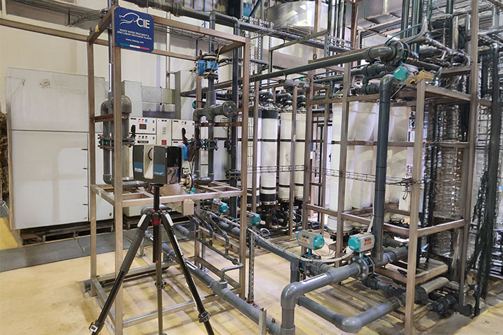
Piping & Equipment Scanning
Accurate capture of pipelines, valves, tanks, and mechanical equipment.
MEP & Utility Systems Scanning
Capture utilities including HVAC, cable trays, and service systems.
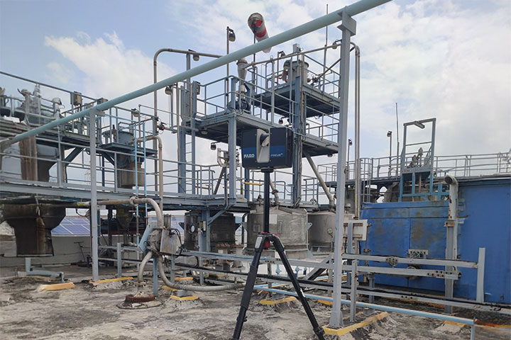
Refinery & Petrochemical Scanning
High-density scanning of processing plants for maintenance and upgrades.
Plant Retrofit & Expansion Scanning
Provide existing condition data for modification and expansion projects.
Industrial Facility Documentation
Generate accurate as-built data for plant operations and asset management.
Why Clients Choose Our Plant Scanning Services
High-Detail Data Capture
Accurate scanning of dense and complex industrial environments.
BIM & Plant Design Integration
Data ready for Plant 3D, BIM, and engineering workflows.
Reduced Site Risk
Minimizes need for repeated site visits in hazardous environments.
Clash Detection Ready Data
Supports coordination and conflict resolution before installation.
Faster Project Execution
Speeds up design, retrofit, and maintenance processes.
Reliable As-Built Information
Ensures accurate representation of existing plant conditions.
Industries We Serve

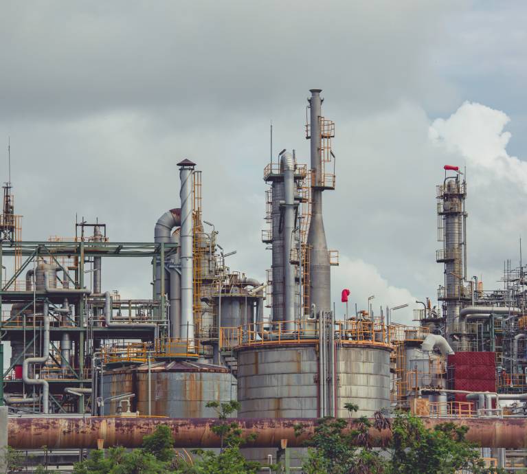
Oil & Gas
Refineries and petrochemical plants

Power
Thermal and renewable energy plants
Chemical
Processing and manufacturing plants

Manufacturing
Industrial production facilities
Pharmaceutical
Process and cleanroom facilities
Utilities
Water treatment and utility plants
Our 3D Laser Scanning Workflow
01
Project Requirement Review
Review:
• Plant scope and access conditions
• Required accuracy and deliverables
02
Scan Planning and Safety Setup
Plan:
• Scanner positions and coverage strategy
• Safety protocols for industrial environments
03
On-Site Laser Scanning
Capture:
• High-density point cloud data of plant areas
• Piping networks, equipment, and structures
04
Point Cloud Registration
Process:
• Align multiple scans into a unified dataset
• Ensure accuracy across large plant areas
05
Point Cloud Cleaning & Segmentation
Refine:
• Remove noise and unwanted data
• Segment systems (piping, equipment, structure)
06
Data Validation & Quality Check
Verify:
• Accuracy and completeness
• Alignment with project requirements
07
Final Data Structuring & Delivery
Organize:
• Plant-ready point cloud datasets
• Structured outputs for modelling and design
Deliverables
- Registered point cloud data (.E57 / .RCP / .RCS / .LAS)
- Segmented plant scan datasets
- BIM/Plant 3D-ready data
- Scan reports and accuracy documentation
- 2D drawings and layouts (if required) (.DWG / .PDF)
- As-built plant documentation
Featured Success Story
Frequently Asked Questions
It captures precise as-built conditions, allowing accurate planning, retrofitting, and equipment relocation.
Yes, it reduces on-site inspections in hazardous zones while providing accurate digital references for planning.
Scans reveal spatial constraints and exact dimensions, enabling clash-free addition of new systems or equipment.
Absolutely, digital models highlight interferences, helping engineers design modifications efficiently.
Yes, they provide detailed asset positions and layouts, aiding preventive and predictive maintenance.
Yes, precise digital documentation enables efficient planning, minimizing operational disruptions.
Yes, SLAM scanners quickly capture complex layouts without extensive setup, saving time and effort.
LiDAR-based scans achieve millimeter-level accuracy, suitable for engineering, fabrication, and compliance checks.
Yes, point clouds are converted into CAD/BIM models for design, retrofitting, and project documentation.
Accurate digital records demonstrate adherence to safety, regulatory, and operational standards.
Need accurate plant data for retrofit or expansion?
Share your plant details or project scope.
We will provide a clear scanning plan, timeline, and deliverables.
Headquarters
Rajkot Office
Nr. Shreeji Gau Shala, B/h Tulip Party Plot
Premvati, Vavdi, Rajkot – 360004
India
Vadodara Office
Tarsali – Danteshwar Ring Road
Vadodara – 390009
General Inquiries
© 2026 Fibrox 3D. All rights reserved. | Developed by SkyWebTech