Photogrammetry
Convert images into accurate 3D models and survey data with our professional photogrammetry services.
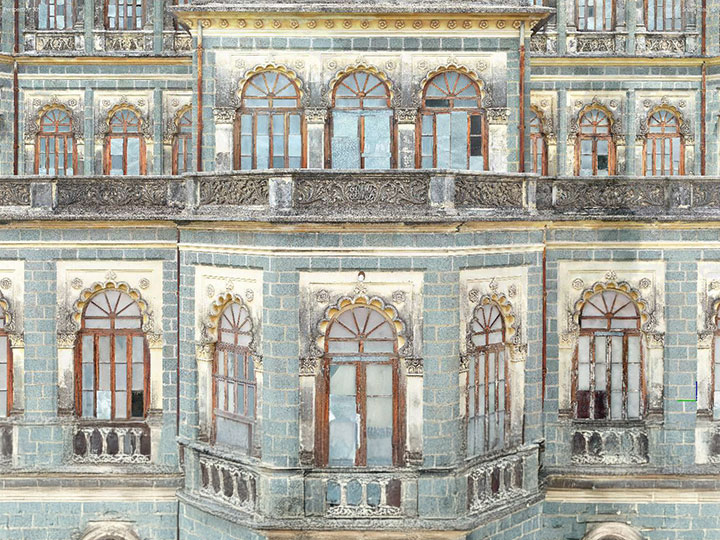
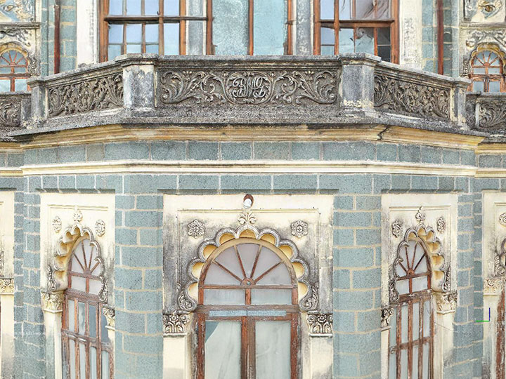
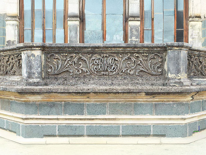
Real-world surfaces, rebuilt as a georeferenced 3D model
Photogrammetry is the process of capturing a large number of overlapping images (70–80% overlap) using ground or aerial photography and processing them to create Photorealistic 3D mesh models, point clouds, and Orthomosaic maps.
Photogrammetry is used across construction, architecture, industrial projects, land surveys, and heritage documentation. The resulting 3D mesh model (3D surface model) represents actual site conditions with clear and accurate geometry.
Our photogrammetry services help you:
- Create accurate 3D mesh models from images
- Generate orthomosaic maps for site analysis
- Capture facades, structures, and large outdoor areas
- Support conservation planning and condition assessment
Industries We Serve

Construction
Site documentation and planning
Architecture
Façade modeling and design reference

Industrial
Asset documentation and inspection
Real Estate
Land mapping and development planning
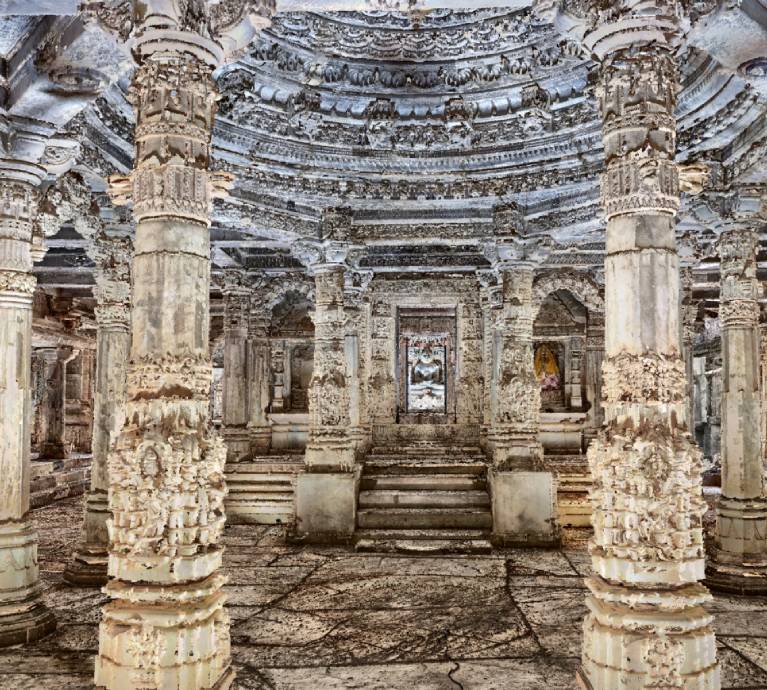
Heritage
Conservation and restoration projects
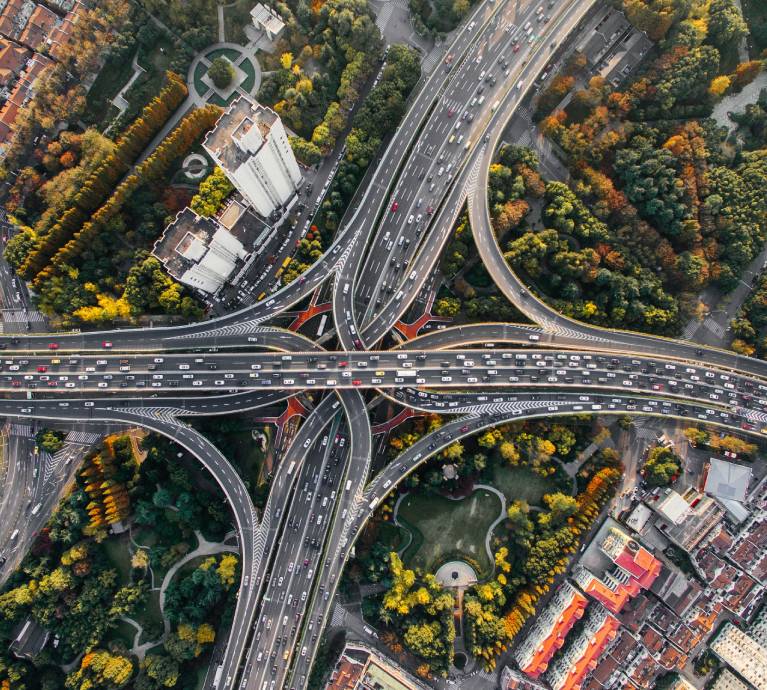
Infrastructure
Roads, utilities, and large outdoor sites
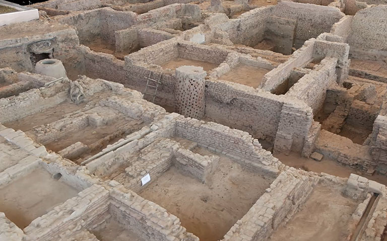
Featured Success Story
Why Clients Choose Our Photogrammetry Services
Optimized and Lightweight 3D Models
We deliver optimized 3D mesh models that are lightweight, easy to handle, and practical to use, instead of large datasets that are difficult to open and manage.
Detailed Surface Representation
Captures real-world textures, geometry, and site conditions in high detail.
Supports Complex Structures
Ideal for heritage buildings, facades, industrial assets, and land parcels.
Integrated with Measured Data
Aligned with survey or scan data to maintain millimetre-level accuracy wherever required.
Faster Capture with Detailed 3D Model
Captures large or complex sites in no time and provides detailed 3D models for better condition assessment compared to 2D photos.
Reliable Output Delivery
We provide data captured onsite by cross verifying onsite by aligning and then reconstruction process keep on office workstation to give client an output within short time.
Our Photogrammetry Workflow
01
Image Planning and Capture
Define coverage, 70–80% overlap, lighting conditions, and capture method. Collect high-resolution images with consistent overlap and minimal shadows for accurate processing.
02
Image Alignment (Aerial Triangulation)
Align images and calculate camera positions to generate a sparse point cloud.
03
Data Alignment / Georeferencing
Align photogrammetry data with laser scan or survey data for improved accuracy.
04
Dense Point Cloud Generation
Process aligned images into a dense point cloud representing detailed geometry.
05
3D Mesh Model Creation
Convert point cloud into a 3D mesh model (3D surface model).
06
Texture Mapping
Apply image textures to generate a realistic textured 3D model.
07
Orthomosaic / DEM Generation
Create georeferenced orthomosaic maps& DEM for accurate 2D representation.
08
Quality Check
Verify model accuracy, alignment, and completeness.
09
Final Delivery
Provide structured outputs ready for design, documentation, and analysis.
Photogrammetry Deliverables
- 3D mesh model / 3D surface model (.OBJ / .FBX/ .PLY)
- Dense point cloud data (.LAS/ .LAZ)
- Textured 3D models
- Ortho mosaic maps (GeoTIFF / high-resolution images)
- 2D drawings and elevations (from processed data)
- Contour maps and surface data
- Measurement outputs (area, distance, volume)
- Aligned datasets with laser scan data (if required)
Frequently Asked Questions
Photogrammetry creates 3D models and measurements from photographs, supporting documentation, mapping, and visualization tasks.
Photogrammetry provides good accuracy for visible surfaces, making it suitable for architectural and heritage documentation.
Photogrammetry is ideal for visual detail and texture capture, while LiDAR is preferred for high-precision industrial surveys.
Yes, photogrammetry supports large-area mapping using drone or ground-based imagery efficiently.
It captures fine architectural details and textures needed for accurate restoration planning.
Architecture, heritage, construction, mining, infrastructure, and surveying benefit from photogrammetry applications.
Yes, photogrammetry outputs can be converted into CAD or BIM-ready formats for further use.
It captures extensive data quickly using images, reducing repeated site visits and manual measurements.
Deliverables include 3D models, textured meshes, orthophotos, point clouds, and measurement reports.
Photogrammetry depends on lighting and visibility and may be less effective in highly congested or enclosed environments.
Start your photogrammetry project today.
Need accurate 3D models or mapping using photogrammetry?
Share your project details or image data.
Our team will review and provide a clear proposal.
Headquarters
Rajkot Office
Nr. Shreeji Gau Shala, B/h Tulip Party Plot
Premvati, Vavdi, Rajkot – 360004
India
Vadodara Office
Tarsali – Danteshwar Ring Road
Vadodara – 390009
General Inquiries
© 2026 Fibrox 3D. All rights reserved. | Developed by SkyWebTech