Drone Surveying
Drone Surveying & Aerial Mapping Services for Accurate Site Data
We provide drone surveying and aerial mapping services to help engineers, surveyors, and project teams to collect reliable site data without delays. Our team delivers high-resolution aerial data and accurate measurements for land surveys, construction projects, and infrastructure planning.
Our drone surveys help you:
- Cover large areas in less time
- Improve survey accuracy
- Reduce site visits and manual effort
- Get clear visual data for better decision-making
Industries Using Drone Surveying
Industries We Serve

Construction
Site planning, progress tracking
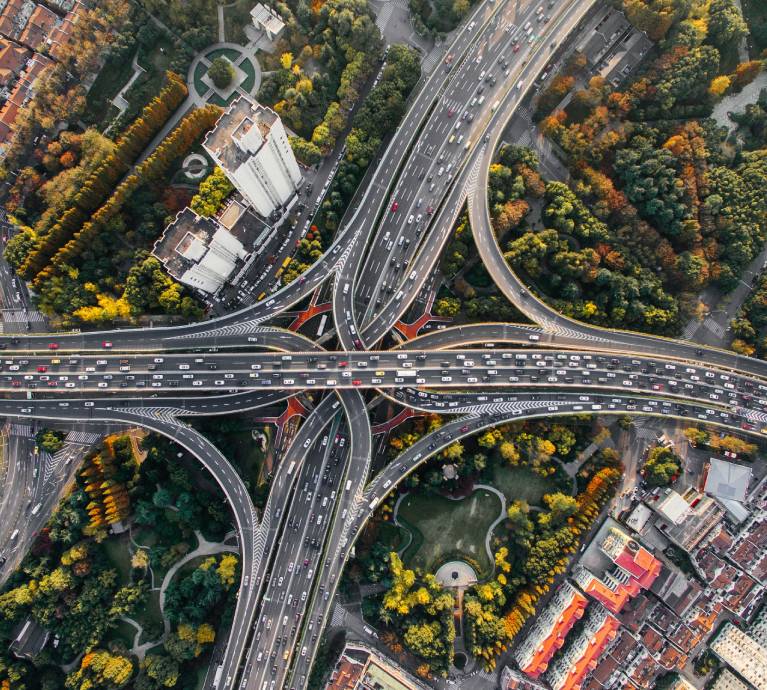
Infrastructure
Roads, railways, utilities, waterways, town planning

Real Estate
Land surveys, development planning
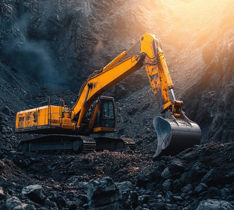
Mining
Volume calculations, site monitoring

Agriculture
Land mapping and analysis, solar farm planning

Industrial
Plant layout and site assessment
Featured Success Story
Why Clients Choose Our Drone Surveying Services
Fast Data Collection
Capture large and complex sites quickly using aerial surveys.
High Accuracy Output
Reliable survey data suitable for planning, design, and measurement.
Cost-Effective Surveys
Reduce time, manpower, and overall survey costs.
Access to Difficult Areas
Easily survey hard-to-reach or unsafe locations.
Scalable for Any Project
Suitable for small land parcels to large infrastructure projects.
Reliable Delivery
Structured workflow ensures timely and consistent results.
Our Drone Surveying Workflow
01
Project Planning
After award of project, we understand site requirements, survey scope, and data output needs.
02
Drone Data Capture (Photogrammetry / Lidar)
Conduct aerial survey to collect high-resolution images with survey grade RTK drones or, drone lidar scanning and surveying onsite.
03
Data Processing
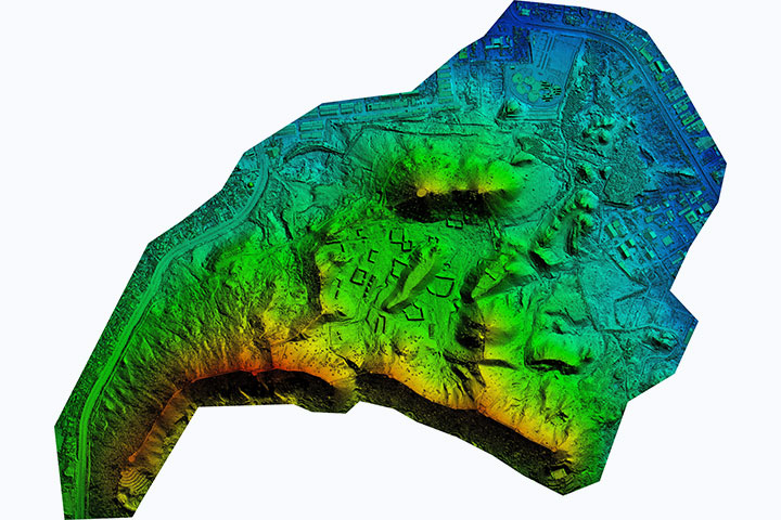
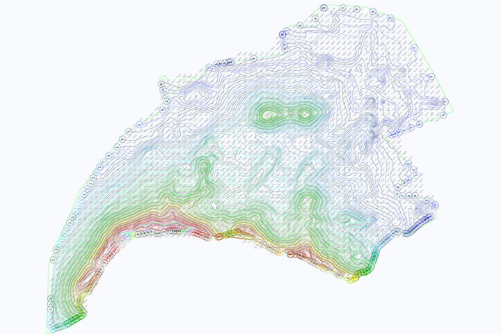
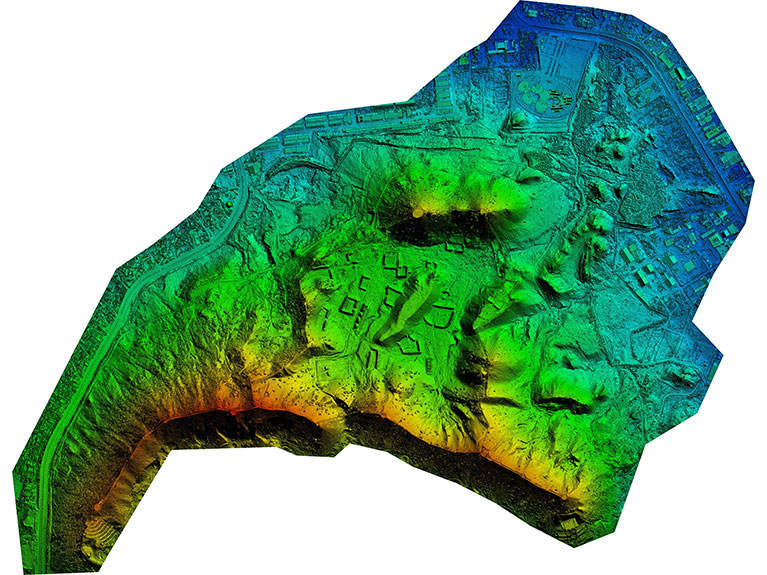
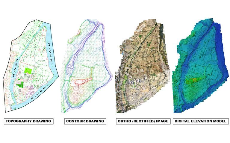
Process captured data to generate accurate 3D maps and survey outputs in terms of topography and contour drawings.
04
Quality Check
Verify data accuracy (in terms of levels, geodetic projections as per the site locations) and completeness(as per client requirements) before delivery.
05
Final Delivery
Provide processed survey data ready for design, planning, and analysis.
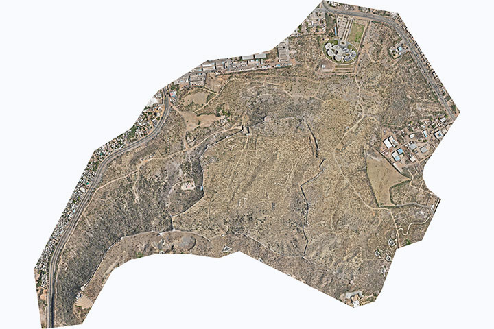
Drone Surveying Deliverables
- Drone survey data
- Aerial maps and site imagery
- Geotagged images
- Orthorectified image (.tiff, .jpeg)
- digital elevation model (.tiff, .jpeg)
- digital surface model (.tiff)
- digital terrain model (.tiff)
- Contour drawings(.dwg)
- Shape files (.shp)
- 3D point cloud data (.las, .e57)
- 3D Mesh model (.obj, .fbx)
- Flythrough video of site (.mp4)
- Topographic survey data with all on ground features with client specified template (.dwg)
Frequently Asked Questions
Drone surveying captures aerial data quickly, helping document large sites, structures, and hard-to-reach areas safely and efficiently.
Drones collect high-resolution images and data, enabling accurate mapping, measurements, and visual records of site conditions.
Yes, drone surveys help track progress, validate work, and monitor changes throughout construction phases.
It reduces the need for manual access to hazardous or elevated areas, minimizing safety risks during surveys.
Drone surveys are ideal for heritage sites as they capture detailed data without physical contact or structural disturbance.
Drone photogrammetry delivers reliable accuracy for mapping, volume calculations, and documentation when supported by ground control.
Deliverables include orthomosaic maps, 3D models, point clouds, elevation data, and inspection visuals.
Drones cover large areas quickly, reducing survey time and costs compared to traditional ground-based methods.
Yes, drone data integrates seamlessly with BIM and GIS platforms for planning and analysis.
Drone surveying is faster, safer, and more cost-effective for large or inaccessible sites.
Start your drone surveying project today.
Need fast and accurate site data through drone surveying?
Share your project details or site location.
Our team will review and provide a quick proposal.
Headquarters
Rajkot Office
Nr. Shreeji Gau Shala, B/h Tulip Party Plot
Premvati, Vavdi, Rajkot – 360004
India
Vadodara Office
Tarsali – Danteshwar Ring Road
Vadodara – 390009
General Inquiries
© 2026 Fibrox 3D. All rights reserved. | Developed by SkyWebTech