Mobile LiDAR Mapping Services
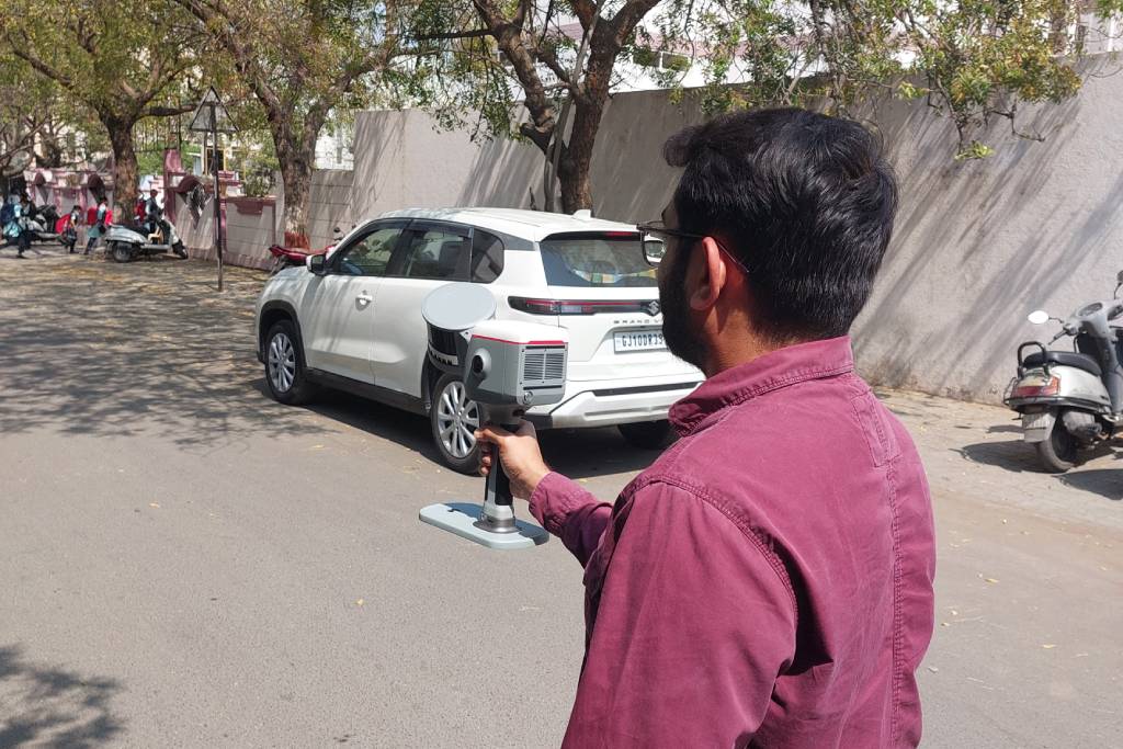
Capture accurate spatial data for roads, highways, railways, and urban environments using advanced Mobile LiDAR Mapping and 3D mobile mapping systems.
Mobile LiDAR Mapping Services for Infrastructure & Urban Projects
Mobile LiDAR Mapping Services capture accurate spatial data for roads, highways, railways, and large urban environments.
Mobile mapping systems collect LiDAR point cloud data that supports infrastructure planning, corridor mapping, and digital city modelling.
We process mobile LiDAR datasets into structured point cloud data, CAD drawings, BIM models, and GIS-ready datasets for surveyors, engineers, infrastructure consultants, and government agencies.
Industries Using Mobile Mapping
Industries Using Mobile LiDAR Mapping
Our mobile mapping and LiDAR data processing services support projects across multiple sectors.

Transportation Infrastructure
Roads, highways, railways, and bridge corridor mapping.

Urban Planning
City-scale mapping and smart city planning.

Utilities and Asset Management
Mapping of pipelines, power lines, and utility infrastructure.

Construction and Engineering
Existing site condition documentation for design and construction.

Environmental and Terrain Mapping
Topographic mapping and terrain analysis for environmental studies.
Featured Success Story
Mobile LiDAR Mapping & Data Processing Services
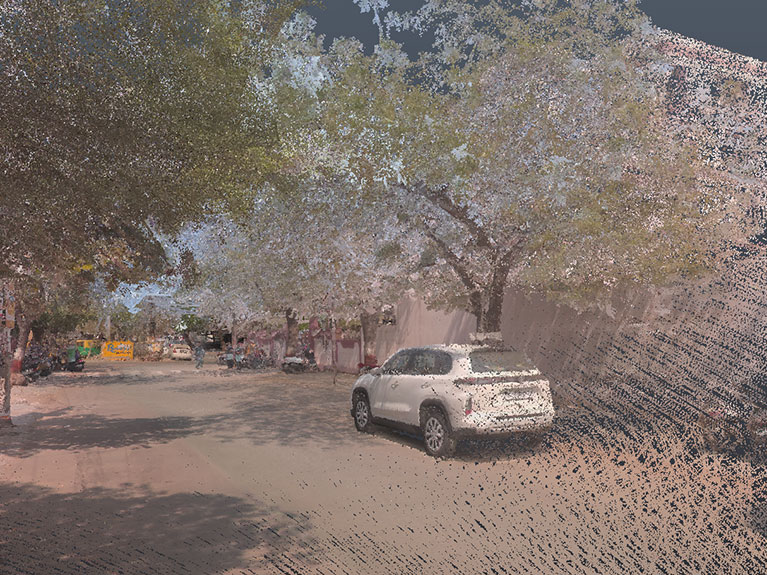
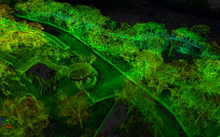
Mobile LiDAR Data Processing
Processing raw mobile LiDAR point cloud data into organized and structureddatasets suitable for engineering and GIS workflows.
Point Cloud Classification
Classification of LiDAR data into terrain, roads, buildings, utilities, and vegetation for better analysis and mapping.
Mobile LiDAR to CAD
Conversion of LiDAR point clouds into 2D CAD drawings such as Topography drawings, contour plan and cross & L sections along with infrastructure layouts using AutoCAD.
Mobile LiDAR to BIM
Development of LOD200 BIM models from mobile LiDAR scans for planning, design and digital asset management.
Mobile LiDAR Data Processing Workflow
01
Data Acquisition
Mobile mapping systems capture LiDAR point cloud data while moving through project corridors.
02
Point Cloud Processing
Raw LiDAR scans are cleaned, aligned, and structured using Point cloud processing software.
03
Point Cloud Classification
Terrain, buildings, roads, and utilities are classified within the LiDAR dataset.
04
CAD or BIM Conversion
Processed LiDAR data is converted into CAD drawings or BIM models depending on project requirements.
05
Quality Control
All outputs are verified against the original LiDAR scan data.
06
Project Delivery
Final deliverables include point cloud datasets, CAD drawings, BIM models, or GIS-ready data.
Mobile LiDAR Deliverables
Clients receive deliverables compatible with engineering, BIM, and GIS platforms.
- Processed LiDAR point cloud datasets
- Classified point cloud data
- 2D CAD drawings from LiDAR scans
- BIM-ready models for infrastructure projects
- GIS-compatible spatial datasets for ArcGIS
Frequently Asked Questions
Mobile mapping uses SLAM-based scanners to capture accurate spatial data while moving, enabling rapid documentation of large or complex environments.
Mobile mapping captures data continuously during walkthroughs, eliminating static setups and significantly reducing on-site survey duration.
Modern SLAM systems deliver reliable accuracy suitable for BIM modeling, layout planning, and general as-built documentation needs.
Mobile mapping works best in large interiors, industrial plants, corridors, warehouses, and areas difficult to scan with static scanners.
It quickly captures existing conditions, helping teams plan renovations accurately without disrupting ongoing operations.
Yes, mobile mapping data is often integrated with static LiDAR scans to balance speed and high-precision requirements.
It reduces time spent in hazardous or congested areas, improving safety by minimizing manual measurement activities.
Deliverables include point clouds, CAD drawings, BIM-ready data, layouts, and as-built documentation.
It captures congested brownfield environments quickly, supporting accurate planning without relying on outdated drawings.
Mobile mapping is faster, less intrusive, and more efficient than traditional surveys for large or complex spaces.
Start Your Mobile LiDAR Mapping Project
Looking for reliable Mobile LiDAR Mapping Services or LiDAR data processing?
Share your LiDAR dataset or project scope, and our team will review the data and provide a quick project proposal.
Headquarters
Rajkot Office
Nr. Shreeji Gau Shala, B/h Tulip Party Plot
Premvati, Vavdi, Rajkot – 360004
India
Vadodara Office
Tarsali – Danteshwar Ring Road
Vadodara – 390009
General Inquiries
© 2026 Fibrox 3D. All rights reserved. | Developed by SkyWebTech