Introduction to Mesh Modeling in Reality Capture
In today’s digital construction and engineering landscape, reality capture technology is transforming how professionals document, analyze, and visualize physical environments. One of the most important components of this process is mesh modeling, which converts captured spatial data into detailed 3D surfaces for visualization, analysis, and project planning.
At Fibrox3D, advanced mesh modeling solutions help architects, engineers, contractors, and infrastructure professionals create accurate digital representations of real-world structures. By combining laser scanning, photogrammetry, and intelligent 3D processing techniques, mesh models provide realistic and data-rich visual outputs for complex projects.
From heritage preservation to industrial facility documentation, mesh modeling in reality capture projects improves accuracy, efficiency, and collaboration across every project stage.
What is Mesh Modeling?
Mesh modeling is the process of creating a 3D surface model using interconnected polygons, typically triangles or quadrilaterals, generated from point cloud data or captured images. These polygons form a “mesh” that represents the shape and geometry of real-world objects or environments.
Unlike traditional CAD models, mesh models focus on accurately representing surfaces and textures. This makes them highly effective for visualization, digital twins, inspection, reverse engineering, and as-built documentation.
Modern mesh modeling solutions are widely used in architecture, engineering, construction, manufacturing, and infrastructure projects because they provide realistic digital representations with high geometric accuracy.
Understanding Reality Capture Technology
Reality capture technology collects accurate spatial information from physical environments and converts it into digital 3D data. Advanced mesh modeling services rely on high-quality capture methods to generate precise models.
Laser Scanning
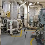
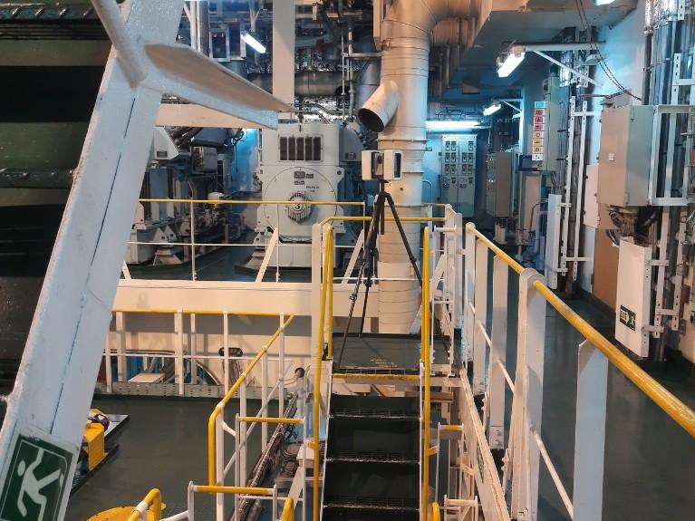
Laser scanning uses LiDAR technology to capture millions of data points from structures and environments. These points create dense point clouds that serve as the foundation for accurate mesh generation.
Laser scanning is commonly used for:
- Industrial facilities
- Building documentation
- Infrastructure projects
- Heritage preservation
- Construction verification
Its high accuracy makes it ideal for detailed 3D mesh modeling workflows.
Photogrammetry
Photogrammetry converts overlapping photographs into 3D spatial data. Specialized software analyzes image patterns and generates detailed point clouds and textured mesh models.
This method is widely used for:
- Heritage documentation
- Real estate visualization
- Large outdoor environments
- Drone mapping projects
Photogrammetry is cost-effective and highly efficient for creating realistic textured mesh models.
Drone-Based Data Capture
Drone-based reality capture enables professionals to scan large or hard-to-access areas quickly and safely. Drones equipped with cameras or LiDAR sensors collect high-resolution data for terrain modeling, infrastructure analysis, and site inspection.
Drone scanning combined with advanced mesh modeling solutions allows faster project execution and enhanced visual accuracy.
How Mesh Modeling Works in Reality Capture Projects
The mesh modeling process begins with data collection through laser scanners, drones, or photogrammetry systems. Once captured, the raw data is processed into point clouds and converted into polygon-based mesh surfaces.
Advanced software tools analyze spatial relationships between points and automatically generate connected geometric surfaces. These surfaces are then refined, optimized, and textured to create realistic and accurate 3D models.
In modern reality capture projects, mesh modeling helps stakeholders visualize existing conditions, identify structural issues, and support renovation or digital twin workflows.
Types of Mesh Models Used in 3D Reconstruction
Different projects require different types of mesh models depending on accuracy, visualization, and project goals.
Polygon Mesh
Polygon mesh models use interconnected polygons to define the geometry of objects and structures. These models are commonly used for engineering analysis, simulations, and structural visualization.
Polygon meshes are lightweight and ideal for large-scale infrastructure and industrial projects.
Textured Mesh
Textured mesh models combine geometric surfaces with photographic textures to create realistic visual representations. These models are widely used in architecture, heritage preservation, and virtual tours.
Textured meshes provide better visualization for presentations, planning, and stakeholder communication.
High-Resolution Mesh
High-resolution mesh models contain dense polygon structures for maximum detail and precision. These models are suitable for complex industrial environments, reverse engineering, and detailed inspection projects.
High-resolution mesh modeling services ensure highly accurate surface representation for critical applications.
The Complete Mesh Modeling Workflow
Professional mesh modeling solutions follow a structured workflow to ensure high-quality and accurate results.
Data Collection
The first step involves collecting accurate spatial data using laser scanners, drones, or photogrammetry systems. Proper planning and scanning techniques ensure complete coverage and reliable outputs.
Point Cloud Processing
Captured data is processed into organized point clouds. Noise removal, alignment, and registration are performed to improve accuracy before mesh generation.
Mesh Generation
Specialized software converts point cloud data into polygon-based mesh surfaces. This step creates the actual 3D geometry of the scanned environment.
Optimization & Cleanup
After generation, the mesh model is optimized by removing unwanted artifacts, correcting surface errors, and reducing unnecessary polygon density.
Optimization improves model performance while maintaining geometric accuracy.
Texturing & Visualization
The final step involves applying textures, colors, and visual enhancements to create realistic 3D outputs. These models can then be used for BIM workflows, digital twins, simulations, and visualization platforms.
Challenges in Mesh Modeling Projects
Although mesh modeling in reality capture provides numerous benefits, several challenges can affect project quality and efficiency.
Large datasets often require significant processing power and storage capacity. Complex environments with reflective or transparent surfaces can also reduce scanning accuracy.
Other common challenges include:
- Incomplete scan coverage
- Data noise and distortions
- Heavy file sizes
- Surface reconstruction errors
- Long processing times
Professional expertise and advanced software tools are essential for overcoming these issues and delivering reliable results.
Why Choose Professional Mesh Modeling Services
Professional mesh modeling services ensure accuracy, efficiency, and reliable project delivery. At Fibrox3D, advanced workflows and experienced specialists help convert raw reality capture data into intelligent and high-quality 3D models.
Professional solutions provide:
- Accurate digital documentation
- Faster project execution
- Improved collaboration
- Better visualization and analysis
- Reliable as-built modeling
- Scalable solutions for complex projects
Fibrox3D combines industry expertise with advanced technology to deliver customized mesh modeling solutions for architecture, engineering, industrial, and infrastructure applications.
Conclusion
Advanced mesh modeling solutions for reality capture projects are transforming the way industries document and visualize physical environments. By converting real-world data into detailed 3D models, mesh modeling improves project planning, visualization, analysis, and decision-making.
Whether using laser scanning, photogrammetry, or drone-based capture methods, high-quality mesh models provide accurate digital representations for modern construction and engineering workflows.
At Fibrox3D, we deliver precise and scalable mesh modeling services tailored to complex project requirements. From industrial facilities to heritage structures, our reality capture expertise helps clients achieve better accuracy, efficiency, and digital transformation outcomes.
FAQs
1. What is mesh modeling in reality capture?
Mesh modeling is the process of converting point cloud or image-based data into polygon-based 3D surface models for visualization, analysis, and documentation.
2. What industries use mesh modeling services?
Mesh modeling is widely used in architecture, engineering, construction, manufacturing, infrastructure, and heritage preservation projects.
3. What is the difference between point clouds and mesh models?
Point clouds consist of spatial data points, while mesh models convert those points into connected surfaces for realistic 3D visualization.
4. Why is mesh modeling important in 3D reconstruction?
Mesh modeling creates accurate digital representations of physical environments, helping improve visualization, planning, inspection, and project analysis.
5. How accurate are professional mesh modeling solutions?
Professional mesh modeling solutions can achieve highly accurate results depending on the quality of the captured data and processing workflows.