Introduction
Large-scale mapping projects come with real challenges. Whether the project covers highways, railway corridors, city streets, utility networks, or sprawling infrastructure sites, survey teams need to collect a huge volume of accurate spatial data in a limited time.
Traditional surveying methods still have their place, but capturing individual measurements across a large project area demands significant field time and resources. Mobile LiDAR Mapping Services offer a faster, more efficient way to capture detailed 3D information across extensive areas – without slowing your project down.
What Are Mobile LiDAR Mapping Services?
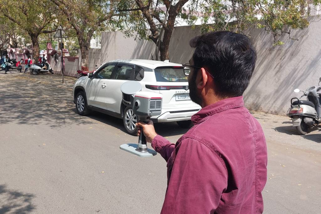
Mobile LiDAR Mapping Services use vehicle-mounted laser scanning technology to collect detailed geospatial data while the survey platform is in motion. LiDAR stands for Light Detection and Ranging. It works by sending laser pulses toward surrounding surfaces and measuring the reflected signals to calculate precise distances.
A typical mobile mapping system includes:
- LiDAR scanners
- GNSS receivers
- Inertial Measurement Units (IMUs)
Together, these components let survey teams capture millions of data points describing an environment, all while moving through it at normal traffic speed.
How Do Mobile LiDAR Mapping Services Work?
The mobile LiDAR workflow generally moves through five stages: planning, data collection, positioning, processing, and final deliverables.
- Survey Planning
Every successful project starts with careful planning. Before any data is collected, the survey team reviews project boundaries, required accuracy, corridor length, driving routes, GNSS availability, and the point density needed for the deliverables.
- Mobile Data Collection
As the vehicle moves, the system continuously scans its surroundings. Laser pulses reflect off nearby surfaces and return to the sensor, capturing information about road surfaces, buildings, bridges, barriers, road signs, streetlights, and utility poles – all in a single pass.
- Positioning and Navigation
GNSS technology establishes location, while the IMU tracks movement and orientation. Together, they determine the vehicle’s position, direction, speed, orientation, and acceleration throughout the survey, which is essential for accurately georeferencing every point collected.
- Point Cloud Processing
Once field data is collected, it’s processed using specialized software. This stage includes trajectory adjustment, point cloud registration, noise removal, filtering, georeferencing, point classification, and accuracy checks – the same rigor we apply across our laser scanning projects.
- Feature Extraction and Final Output
With a clean, processed point cloud, relevant features are extracted based on project needs. Final deliverables can include classified point clouds, topographic drawings, Digital Terrain Models, Digital Surface Models, CAD drawings, or GIS datasets – whatever format your engineering team works in.
Why Is Mobile LiDAR Ideal for Large-Scale Mapping Projects?
Large mapping projects involve long distances, complex environments, and dense infrastructure – conditions where mobile LiDAR consistently outperforms traditional methods.
Rapid Data Collection
Because data is captured while moving, large roads, highways, railways, and urban areas can be surveyed in a fraction of the time traditional methods require.
High Accuracy & Dense Point Clouds
Mobile LiDAR generates millions of precise data points, producing highly detailed 3D models suitable for engineering, infrastructure planning, and GIS applications.
Improved Safety
Collecting data from a moving vehicle reduces the need for surveyors to work on high-traffic roads or in hazardous, hard-to-access locations.
Cost-Effective for Large Areas
Covering long distances in less time, with fewer field visits, lowers overall project costs while increasing efficiency.
Versatile Across Industries
From transportation planning and smart cities to utilities, construction, mining, and environmental monitoring, mobile LiDAR adapts to nearly any large-scale mapping need. For sites that also require aerial coverage, it pairs well with drone surveying to fill in areas a ground vehicle can’t reach.
Where Are Mobile LiDAR Mapping Services Used?
Road and Highway Mapping
Road networks are one of the most common applications. Mobile LiDAR captures road geometry, surfaces, lane areas, kerbs, and barriers – data that supports road improvement, widening, maintenance, and asset management projects.
Railway Corridor Mapping
Railway infrastructure often stretches over long distances with many assets to document, including tracks, platforms, signals, bridges, and tunnels. The resulting point cloud supports engineering analysis, infrastructure planning, and clearance studies.
Urban Mapping
Cities combine buildings, roads, street furniture, and public infrastructure in complex layouts. Mobile LiDAR creates detailed digital records that support smart city planning, street asset mapping, and transportation analysis.
Airport Infrastructure Mapping
Airports contain extensive road networks, buildings, and service areas. Mobile LiDAR supports infrastructure planning, asset documentation, roadway mapping, and maintenance planning across accessible zones.
Industrial Facility Mapping
Large industrial sites often have complex outdoor environments with roads, structures, and utility infrastructure. Mobile LiDAR efficiently documents accessible areas, feeding directly intoplant as-built modeling for facilities that need a full digital twin.
The Future of Mobile LiDAR Mapping
Mobile LiDAR technology keeps advancing – with better sensors, faster positioning, and smarter automation. Emerging workflows are already benefiting from faster point cloud processing, AI-assisted classification, improved asset detection, tighter GIS integration, and full digital twin development.
As infrastructure owners rely more on digital data for planning and asset management, detailed 3D mapping will only become more valuable – not less.
Conclusion
Large-scale mapping projects demand efficient data collection, detailed spatial accuracy, and dependable deliverables. Mobile LiDAR Mapping Services deliver all three, making them a practical solution for roads, railway corridors, urban areas, utility routes, airports, and industrial environments.
If you’re planning a large-scale mapping project and want data you can actually trust on-site, get in touch with our team for a scoped quote.
FAQs
1. What are Mobile LiDAR Mapping Services?
Ans: They use vehicle-mounted LiDAR scanners to quickly collect accurate 3D geospatial data across large areas.
2. Why is Mobile LiDAR useful for large-scale projects?
Ans: It provides fast data collection, wide-area coverage, and detailed 3D mapping with minimal fieldwork.
3. Where is Mobile LiDAR commonly used?
Ans: Highways, railways, urban mapping, utility corridors, airports, and industrial sites.
4. What outputs can Mobile LiDAR provide?
Ans: Point clouds, 3D models, terrain models, CAD drawings, GIS data, and asset maps.
5. How do I choose a Mobile LiDAR service provider?
Ans: Check their project experience, equipment, data accuracy, processing expertise, quality control process, and available deliverables.