Introduction:
Industrial plants contain complex networks of piping, equipment, structural steel, cable trays, platforms, tanks, and utility systems. Accurate information about these existing conditions is essential for plant design, maintenance, retrofit, expansion, and engineering coordination.
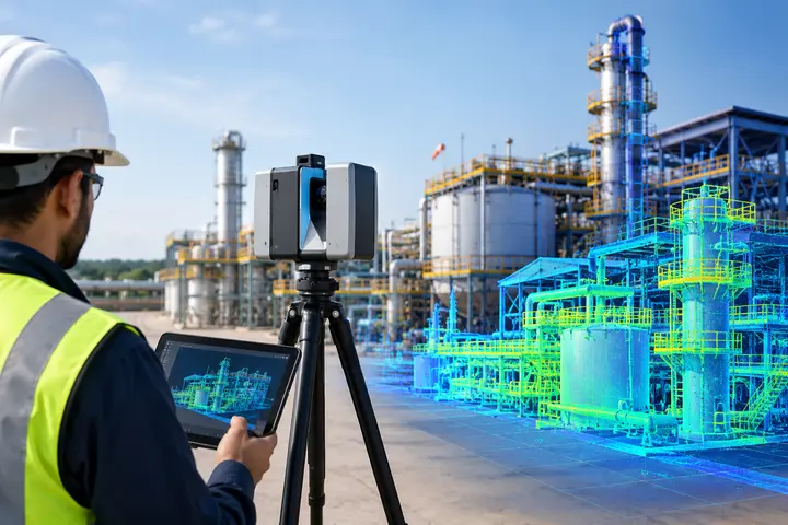
Traditional measurement methods can be time-consuming and may not capture every detail of a complex facility. 3D laser scanning provides a more comprehensive approach by capturing millions of spatial measurement points and converting the physical plant into a detailed 3D point cloud.
The accuracy of plant scanning depends not only on the scanner but also on scan planning, positioning, registration, data processing, and quality control. Therefore, selecting the right combination of scanning hardware and software is important for reliable results.
What Tools Are Used for Plant Scanning?
Different tools can be used depending on the size, complexity, accessibility, and accuracy requirements of the industrial facility.
1. Terrestrial 3D Laser Scanners
Terrestrial laser scanners are among the most commonly used tools for detailed industrial plant scanning. These scanners are generally mounted on tripods and capture high-density point cloud data from fixed positions.
They are particularly useful for documenting:
- Piping systems
- Process equipment
- Tanks and vessels
- Structural steel
- Platforms and supports
- MEP and utility systems
Modern scanners such as the Leica RTC360 and Trimble X9 are designed for professional reality-capture workflows and are used across applications including construction, industrial facilities, oil and gas, and plant documentation.
The right scanner should be selected based on required accuracy, range, scanning speed, site conditions, and project deliverables rather than simply choosing the most expensive equipment.
2. Mobile and SLAM Laser Scanners
Mobile or SLAM-based scanners can be useful when large or complicated plant areas need to be captured quickly.
Unlike conventional tripod-based scanning, SLAM systems can be moved through a facility while continuously collecting spatial data. They can be useful for corridors, production areas, warehouses, utility spaces, and other environments where rapid coverage is important.
However, SLAM scanning should be selected according to the project’s required accuracy and environmental conditions. For highly detailed engineering applications, it may be combined with static terrestrial scanning.
3. Survey Control and Positioning Equipment
Accurate plant scanning may also require survey control equipment and reference points.
Control points, targets, total stations, GNSS equipment, or other positioning methods can help connect scan data to the required project coordinate system.
This becomes particularly important for large plants where numerous scan positions must be combined into one coordinated dataset.
4. Point Cloud Registration Software
Capturing individual scans is only the beginning of the workflow. Multiple scans need to be aligned and registered into a unified point cloud.
Specialized software helps operators register, inspect, clean, and organize scan data. For example, Fibrox 3D’s plant scanning workflow includes point cloud registration, cleaning, segmentation, validation, and final data structuring.
Software selection should depend on the scanner, project requirements, file formats, accuracy requirements, and intended deliverables.
5. CAD, BIM and Plant Design Software
The final point cloud can be used as a reference for engineering and modeling workflows.
Depending on the project, scan data may support:
- AutoCAD drawings
- Revit models
- Autodesk Plant 3D
- Navisworks coordination
- Plant as-built models
- Clash detection
- Piping layouts
- Equipment modeling
Point cloud data can therefore become more than a survey record—it can provide the foundation for digital plant documentation and engineering design.
How to Choose the Right Plant Scanning Tools
There is no single tool that is best for every industrial plant. The appropriate solution depends on several factors:
Project size: Large facilities may require scanners with suitable range and efficient registration workflows.
Required accuracy: Engineering and fabrication projects may require higher-accuracy scanning than general documentation.
Site accessibility: Tight or difficult-to-access areas may benefit from mobile or specialized scanning equipment.
Surface and environmental conditions: Reflective surfaces, dust, outdoor conditions, and other site factors should be considered during planning.
Final deliverables: The required output – such as point clouds, CAD drawings, BIM models, or plant models – should influence the scanning and processing workflow.
Why Accurate Plant Scanning Matters
Accurate plant scanning provides a reliable digital representation of existing conditions. It can support plant retrofit, expansion, maintenance, equipment relocation, clash detection, as-built documentation, and digital-twin development.
It can also reduce dependence on repeated manual measurements and help engineering teams identify spatial constraints before modifications are made.
Conclusion
The best tools for accurate plant scanning in India are not limited to a particular scanner or software package. A successful project requires the right combination of 3D laser scanners, mobile scanning technology, survey control, registration software, point cloud processing, and CAD/BIM or plant-design tools.
More importantly, accurate results depend on proper planning, experienced operators, suitable equipment, and thorough quality control.
Fibrox 3D provides 3D laser scanning and plant documentation services in India, helping industrial facilities capture existing conditions for engineering, retrofit, expansion, BIM, Plant 3D modeling, and as-built documentation.
FAQs
1. What is the best tool for industrial plant scanning?
Ans: Terrestrial 3D laser scanners are often suitable for detailed plant documentation, while mobile scanners can complement them where rapid coverage is required.
2. Can 3D laser scanning be used for plant retrofits?
Ans: Yes. Laser scanning captures existing piping, equipment, structures, and spatial constraints, helping engineers plan retrofit modifications and identify potential clashes.
3. What software is used to process plant scan data?
Ans: Point cloud software is used for registration and processing, while CAD, BIM, and plant-design platforms can use the resulting data for modeling.
4. Is mobile scanning suitable for industrial plants?
Ans: Mobile SLAM scanning can efficiently capture large or complex areas, but suitability depends on the required accuracy, environment, coverage, and final project deliverables.
5. What are the deliverables from plant scanning?
Ans: Typical deliverables include registered point clouds, segmented datasets, CAD drawings, BIM or Plant 3D-ready data, scan reports, and as-built documentation.