Introduction to LiDAR 3D Scanning
The construction and infrastructure industries are rapidly adopting digital technologies to improve project accuracy, efficiency, and collaboration. One of the most advanced technologies transforming modern construction workflows is LiDAR 3D scanning. From BIM modeling and infrastructure documentation to digital twins and facility management, LiDAR technology is becoming essential for accurate reality capture and intelligent project planning.
Today, advanced LiDAR 3D scanning solutions help architects, engineers, contractors, and facility managers capture highly accurate site data and convert it into intelligent digital models. These workflows support better decision-making, reduce construction errors, and improve coordination across all project stages.
At Fibrox3D, we provide high-precision LiDAR 3D scanning services for BIM, infrastructure, industrial facilities, and construction projects. Our reality capture solutions combine advanced scanning technology with intelligent digital workflows to deliver accurate and efficient project outcomes.
What is LiDAR 3D Scanning?
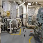
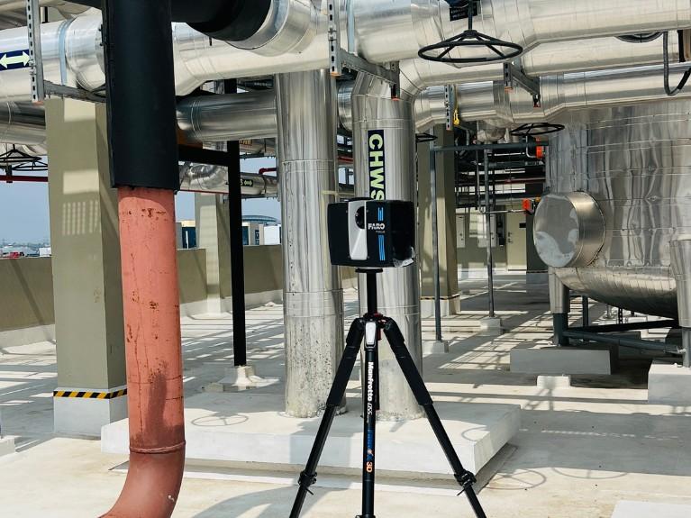
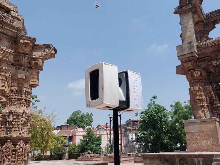
LiDAR 3D scanning (Light Detection and Ranging) is an advanced reality capture technology that uses laser pulses to measure distances and create highly accurate 3D representations of physical environments.
The scanning system emits thousands of laser beams every second. These laser pulses bounce back after hitting surfaces, allowing the scanner to calculate exact distances and generate detailed spatial data known as a point cloud.
LiDAR technology is widely used for:
- Building documentation
- Infrastructure surveying
- Scan to BIM workflows
- Industrial facility modeling
- As-built documentation
- Digital twin development
- Structural and MEP coordination
How LiDAR 3D Scanning Works
The LiDAR 3D scanning process involves several important steps that transform real-world environments into intelligent digital models.
Laser Data Capture
A LiDAR scanner emits laser pulses toward surrounding objects and surfaces. The scanner measures the time it takes for the laser to return, calculating precise distances.
This process captures millions of measurements within minutes, creating highly accurate spatial data.
Point Cloud Generation
The collected measurements form a dense digital dataset called a point cloud. Each point contains accurate positional information representing walls, floors, structures, equipment, pipelines, and other physical elements.
Point cloud data serves as the foundation for BIM modeling and digital construction workflows.
Data Registration and Processing
Multiple scans from different positions are combined through a process called registration. Specialized software aligns and processes the data into a complete 3D representation of the site.
This stage removes noise, improves accuracy, and prepares the data for BIM integration.
BIM and 3D Model Creation
The processed point cloud data is converted into intelligent BIM models using advanced modeling software. Engineers and BIM specialists create architectural, structural, and MEP models based on real-world site conditions.
This workflow is commonly known as Scan to BIM.
Importance of LiDAR 3D Scanning in Modern
Construction: The construction industry faces increasing pressure to improve efficiency, reduce project delays, and minimize costly errors. Traditional measurement methods often struggle to provide the level of accuracy required for modern projects.
This is where LiDAR 3D scanning solutions provide major advantages.
Accurate Site Documentation: LiDAR scanning captures precise site conditions with millimeter-level accuracy, reducing errors in design and construction planning.
Faster Project Workflows: Compared to manual surveying, LiDAR technology significantly reduces site documentation time and accelerates project delivery.
Better Collaboration: Digital point cloud data allows architects, engineers, contractors, and BIM teams to collaborate using accurate project information.
Reduced Rework and Construction Errors: Accurate BIM models created from LiDAR scans help identify clashes and design conflicts before construction begins.
Support for Digital Construction: LiDAR scanning plays a critical role in BIM, digital twin development, smart infrastructure, and facility management workflows.
Benefits of Advanced LiDAR 3D Scanning Solutions
High-Precision Data Capture: LiDAR technology captures highly accurate measurements that improve BIM modeling and construction planning.
Faster Project Execution: Large areas can be scanned quickly, reducing project timelines and accelerating workflows.
Improved BIM Accuracy: Point cloud-based BIM models provide accurate digital representations of real-world conditions.
Reduced Rework and Project Risks: Early identification of design conflicts minimizes construction errors and costly rework.
Better Collaboration and Coordination: Shared digital models improve communication between architects, engineers, contractors, and project stakeholders.
Cost and Time Savings: Efficient data capture and accurate planning reduce overall project costs and delays.
Improved Site Safety: LiDAR scanning minimizes the need for manual measurements in hazardous or hard-to-access environments.
LiDAR 3D Scanning vs Traditional Surveying Methods
Feature | LiDAR 3D Scanning | Traditional Surveying |
Accuracy | Very High | Moderate |
Speed | Fast | Time-consuming |
Data Density | Millions of points | Limited measurements |
Visualization | Full 3D models | Mostly 2D data |
BIM Integration | Excellent | Limited |
Large-Scale Projects | Highly Efficient | Less efficient |
Industries Using LiDAR 3D Scanning
Many industries now rely on LiDAR 3D scanning services, including:
- Architecture
- Engineering
- Construction
- Infrastructure
- Oil & gas
- Manufacturing
- Utilities
- Industrial plants
- Heritage preservation
- Facility management
Challenges in LiDAR 3D Scanning Projects
While LiDAR technology offers major advantages, projects may also face certain challenges.
- Large Data Management: Point cloud datasets can be extremely large and require advanced processing systems.
- Skilled Workforce Requirements: Experienced BIM and scanning professionals are essential for accurate modeling and data interpretation.
- Software Compatibility: Different BIM and scanning platforms may require careful workflow coordination.
Why Choose Fibrox3D for LiDAR 3D Scanning Services
Fibrox3D provides high-precision LiDAR 3D scanning services for construction, infrastructure, and industrial projects. We combine advanced reality capture technology with BIM expertise to deliver accurate and efficient digital workflows.
Our expertise includes:
- LiDAR 3D Scanning
- Scan to BIM Services
- Point Cloud to BIM Conversion
- Architectural, Structural & MEP BIM
- As-Built Documentation
- Clash Detection & Coordination
With accurate data capture, faster project delivery, and reliable BIM integration, Fibrox3D helps clients improve project planning, reduce errors, and support modern digital construction workflows.
Conclusion
Advanced LiDAR 3D scanning solutions are transforming the way construction, infrastructure, and industrial projects are planned and managed. By providing highly accurate reality capture data, LiDAR technology improves BIM workflows, reduces construction errors, and enhances project coordination.
From Scan to BIM and as-built modeling to digital twins and infrastructure documentation, LiDAR scanning has become an essential part of modern digital construction.
At Fibrox3D, we provide high-precision LiDAR scanning and BIM solutions designed to support efficient, accurate, and future-ready project delivery.
FAQs
1. What is LiDAR 3D scanning used for?
LiDAR 3D scanning is used for BIM modeling, infrastructure surveying, as-built documentation, facility management, industrial plant modeling, and digital twin development.
2. How accurate is LiDAR 3D scanning?
Modern LiDAR scanners can achieve millimeter-level accuracy depending on project conditions and equipment used.
3. What is the difference between LiDAR and traditional surveying?
LiDAR scanning captures millions of accurate 3D data points quickly, while traditional surveying methods rely on manual measurements and limited data collection.
4. How does LiDAR support BIM projects?
LiDAR scanning generates accurate point cloud data that can be converted into intelligent BIM models for design coordination, planning, and facility management.
5. What industries use LiDAR 3D scanning?
Industries including architecture, engineering, construction, infrastructure, manufacturing, oil & gas, and facility management use LiDAR scanning technology.
6. What is Scan to BIM?
Scan to BIM is the process of converting laser-scanned point cloud data into intelligent BIM models representing existing site conditions.