India is building, upgrading and modernizing at a scale few countries match: new highways and metro lines, ageing refineries and process plants, and heritage structures that need careful documentation. All of these projects share one problem. Teams need accurate, up-to-date information about what already exists on site.
That is where LiDAR 3D scanning comes in. In this article we look at where the technology is heading globally, what it means for India, and what project teams should keep in mind as adoption grows. We also draw on our own experience delivering laser scanning and Scan to BIM projects at Fibrox 3D.
What is a LiDAR 3D scanner?
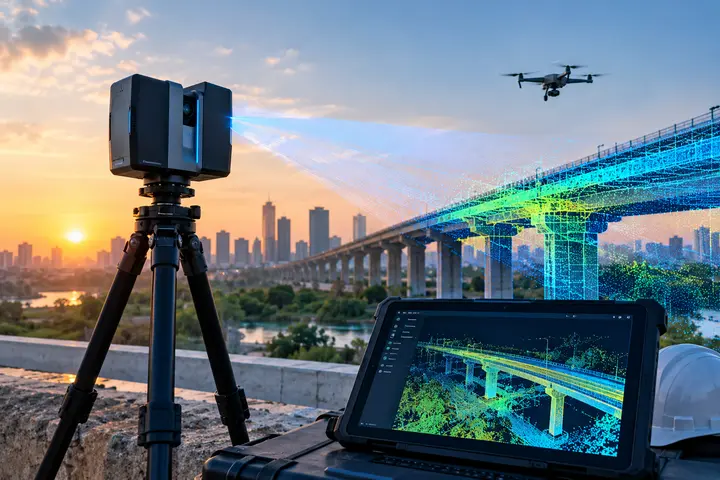
LiDAR stands for Light Detection and Ranging. A scanner sends out laser pulses and measures the time each pulse takes to bounce back from a surface (the time-of-flight principle). Each measurement gives a point with X, Y and Z coordinates. Scanning from many positions produces millions of points, called a point cloud, which forms a detailed 3D record of the site.
Point clouds are then converted into deliverables such as CAD drawings, BIM models and 3D meshes. This is the basis of our 3D laser scanning services.
LiDAR is not radar. Radar uses radio waves, while LiDAR uses laser light.
Five Trends Shaping the Future of Laser Scanning
1. Portable and mobile scanning
Early laser scanners were heavy and slow to set up. Today we also have handheld, backpack-mounted and vehicle-mounted systems. Many use SLAM (Simultaneous Localization and Mapping), which maps an area while tracking the device’s position within it. This is especially useful where satellite positioning is weak or unavailable, such as inside buildings, tunnels, and dense urban areas. Our mobile LiDAR mapping work follows this idea, covering large sites quickly.
2. Drones and combined capture
Drones can reach rooftops, large open areas and hard-to-access locations without putting surveyors at risk. AVEVA describes a Brazilian engineering firm that uses drones to scan existing plants and has cut the number of field survey staff needed on projects. Drone data is often combined with ground scanning and photogrammetry so that each method covers what the others miss. See our drone surveying service for how this works in practice.
3. AI-assisted point cloud processing
A point cloud is only the beginning. Turning millions of points into a usable model involves segmentation, object classification, feature extraction and removing noise. These steps take many engineering hours, and AI tools are starting to automate parts of them. However, automation does not remove the need for expertise. Accuracy, level of detail and documentation requirements still need to be checked by people. At Fibrox 3D, our engineers review deliverables rather than relying on automated output alone.
4. Cloud-based data management
Large projects can produce point clouds measured in terabytes. Moving them on hard drives is slow and risky. Cloud platforms let designers, contractors and owners access the same up-to-date data, and remove some of the need for expensive local hardware. Expect more Indian projects, especially those with multiple contractors and sites, to adopt this way of working.
5. Digital twins, Scan to BIM and immersive tools
For existing assets, a scan is often the first step toward a digital twin: a model that reflects how the site really is. Scan to BIM converts point clouds into intelligent models used for renovation, coordination and facility management. Accurate 3D data also feeds VR and AR tools, which companies use for design reviews and operator training. These tools are only as good as the data underneath them.
Challenges to Plan For
The future is promising, but project teams should be realistic.
Data volume: Large point clouds need proper storage, processing and sharing.
Skills: Good deliverables depend on trained scanning and modelling teams, not only on equipment.
Clear specifications: Accuracy, registration tolerance, level of detail (LOD) and file formats should be agreed before capture, not after.
Human verification: AI-assisted workflows still need quality-control checks.
Data security: Scans of plants and facilities can contain sensitive information and should be stored and shared carefully.
How Fibrox 3D Fits In
Fibrox 3D is a laser scanning and digital engineering company with offices in Rajkot and Vadodara, supporting clients across India and internationally. Our work covers laser scanning, mobile mapping, drone surveying, photogrammetry, BIM services, plant modeling, parametric modeling and mesh modeling.
Some examples of the kinds of projects we deliver:
- Heritage street development: 3D laser scanning of a 1.2 km heritage street to produce as-built elevation drawings for beautification and conservation planning.
- Hill temple staircase: Laser scanning and as-built drawings of a staircase of about 1,000 steps to plan a funicular system for visitors.
- Storage tank calibration: Internal scanning of a storage tank to report on roundness, verticality and volume.
How to Prepare Your Project for Scanning
If you are considering laser scanning, a few questions will help you get the right result:
- What will the data be used for: as-builts, renovation design, inspection, BIM or reverse engineering?
- What accuracy and LOD does that use require?
- What deliverable formats does your design team need?
- What areas are hard to access, and does the site need to keep operating during scanning?
Conclusion
LiDAR 3D scanning in India is growing because the need is real: accurate data about existing plants, infrastructure and heritage structures. Mobile and drone capture, AI-assisted processing, cloud collaboration and digital twins are making scanning faster and more useful. The projects that benefit most will be those that combine good technology with clear specifications and experienced engineers.
If you are planning a scanning or Scan to BIM project, contact Fibrox 3D to discuss your requirements and get a quote.
Frequently Asked Questions
1. What is LiDAR 3D scanning used for in India?
It is used to capture accurate existing-condition data for industrial plants, infrastructure, buildings and heritage sites. The data becomes point clouds, CAD drawings, BIM models and inspection reports.
2. Is LiDAR the same as radar?
No. LiDAR uses laser light to measure distance, while radar uses radio waves.
3. How accurate is LiDAR 3D scanning?
Accuracy depends on the scanner, site conditions, scanning method and required deliverables. Survey-grade laser scanning can reach millimeter-level accuracy, and the required tolerance should be agreed before scanning begins.
4. Will AI replace manual work in laser scanning?
AI can speed up tasks like classifying and cleaning point cloud data, but results still need quality checks by experienced engineers to meet accuracy and documentation requirements.
5. Can LiDAR scanning work where GPS is weak?
Yes. Mobile systems that use SLAM can map indoor spaces, tunnels and dense urban areas by tracking their own position as they move.
6. Does Fibrox 3D provide laser scanning services across India?
Yes. Fibrox 3D provides laser scanning services across India, including Gujarat, Rajkot and Vadodara, and also supports international projects.