Every physical object, building or industrial site can be captured digitally. But raw data alone is rarely enough. A scanner produces millions of points, and a drone or camera produces hundreds of photographs. To make that information useful for design, analysis and documentation, it has to be converted into a clean model your team can actually work with. That is where 3D mesh modeling comes in.
At Fibrox 3D, we work with reality-capture data from laser scanning, mobile mapping, drone surveying, and photogrammetry for industrial, architectural, heritage, and engineering projects. 3D mesh processing is an important part of converting that captured information into usable digital models.
This guide explains what 3D mesh modeling is, how mesh models are created, how they differ from point clouds, CAD and BIM models, where they are used, and what to consider when selecting a 3D mesh modeling service.
What Is 3D Mesh Modeling?
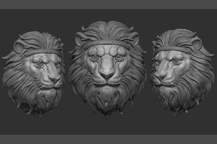
3D mesh modeling is the process of creating a digital representation of an object’s surface using interconnected vertices, edges, and faces.
- Vertices are points positioned in three-dimensional space.
- Edges are lines connecting two vertices.
- Faces are polygonal surface elements formed by connected edges. Triangles and quadrilaterals are commonly used in 3D meshes.
Together, these elements define the shape and surface of a digital object.
Mesh models are particularly useful for objects and environments with complex, irregular, or organic geometry. Examples include weathered stone structures, heritage monuments, curved architectural surfaces, industrial equipment, terrain, mechanical components, and existing facilities.
A mesh can be created manually using 3D modeling software, but in reality-capture projects it is commonly generated from measured or photographic data. A point cloud from laser scanning, or three-dimensional information reconstructed through photogrammetry, can be processed into a polygonal surface and then cleaned, refined, and optimized for its intended use.
Mesh Resolution, Topology and Optimization
The quality and usability of a 3D mesh depend not only on how accurately the surface is captured, but also on how the mesh is structured and optimized.
- Mesh density: A higher number of polygons can preserve more surface detail, but it also increases file size and processing requirements. The appropriate level of detail depends on whether the model is being used for inspection, documentation, visualization, analysis, or design reference.
- Topology: Topology describes how vertices, edges, and faces are arranged across a mesh. For scan-based models, clean and consistent topology can make the mesh easier to edit, process, and use in downstream applications.
- High-resolution vs. optimized meshes: A high-resolution mesh can preserve fine details from the original scan, while an optimized mesh reduces unnecessary polygons to make the model easier to view, share, and work with. The goal is to retain the level of detail required for the project without creating an unnecessarily heavy file.
- Textures and materials: Where required, photographic information can be applied to a mesh as texture data. Textured meshes can provide additional visual information about surface appearance, which is particularly useful for heritage documentation, visualization, and inspection.
3D Mesh Modeling vs. Other Modeling Approaches
Point Cloud : A point cloud is a collection of measured points representing the geometry of an existing object, building, structure, or facility.
It preserves detailed spatial information from the capture process but does not represent the object as a continuous polygonal surface.
3D Mesh : A 3D mesh connects geometric information into a polygonal surface.
Compared with a raw point cloud, a mesh can provide a more continuous visual representation of the captured object or environment and can be useful for visualization, inspection, documentation, measurement, and other 3D workflows.
CAD Model : CAD models are structured digital representations used for engineering design, drafting, manufacturing, and technical documentation.
BIM Model : BIM is an information-management approach for built assets in which a digital representation can combine geometry with structured information and support processes across design, construction, and operation.
How 3D Mesh Modeling Supports Modern Projects
Digital projects need more than attractive visuals. Teams need models that are accurate, reliable, and suitable for the software they use.
Mesh modeling supports this in several ways:
- Accurate representation of existing conditions. Because the mesh is generated from measured scan data, it reflects the site or object as it actually is, not as drawings say it should be.
- Better visualization. Stakeholders can examine a structure or component from any angle without visiting the site again.
- Analysis and planning. Meshes can feed into structural studies, deviation analysis, volume calculations, and design planning.
- Long-term records. A mesh provides a lasting digital record of an object or structure, which is valuable for conservation and maintenance.
Watch Fibrox 3D Youtube Video:
Where Is 3D Mesh Modeling Used?
Heritage and Conservation
Heritage structures often have intricate surfaces, irregular geometry and original drawings that are missing or outdated. Scan-based mesh models capture fine detail without physical contact, giving conservation teams a dependable digital record to plan restoration and long-term protection.
Fibrox 3D has supported heritage documentation projects ranging from a 1.2 km heritage street to a hill temple staircase of around 1,000 steps. Researchers and conservation professionals use this kind of clean, well-registered data for structural analysis and documentation.
Industrial Plants and Engineering
In oil and gas, marine, manufacturing and process industries, existing facilities rarely match their original drawings. Mesh and as-built models help engineering teams understand actual conditions before modification, inspection or retrofit work begins.
Scan-based surface models also support inspection tasks such as checking the condition and geometry of tanks and equipment.
Architecture and Construction
For renovation and refurbishment, mesh models generated from laser scanning and photogrammetry show existing buildings in considerable detail. Architects and contractors can use them as a reference and, where required, move on to Scan to BIM for intelligent building models.
Product Design and Reverse Engineering
When a part has no drawings, a scan can capture its shape and a mesh can record its surface. From there, the data can be used to rebuild an editable model for redesign, replacement or manufacturing.
The 3D Mesh Modeling Process
The exact workflow depends on the project, but most mesh modeling work follows these stages.
- Capturing the source data. Everything starts with good data. This may come from laser scanning, mobile LiDAR mapping, drone surveying, photogrammetry, CAD files, or reference drawings. The quality and completeness of this data strongly affect the final model.
- Registering and preparing the data. Multiple scans are aligned into one coherent dataset, and noise or unwanted points are removed so the model is built on reliable information.
- Generating the initial mesh. Specialized software converts the point cloud or photographic data into a surface made of vertices, edges and faces, establishing the object’s overall shape and proportions.
- Refining the details. The mesh is reviewed and corrected. Holes are filled, surfaces are cleaned, and the details that matter for the project are preserved or improved.
- Optimizing the model. A highly detailed model is not always the most useful one. Too many polygons can make a file hard to open or slow to work with. Optimization reduces unnecessary geometry while keeping the detail your application needs.
- Exporting in the right format. The final mesh is delivered in a format suited to your workflow. Common formats include OBJ, FBX, STL and glTF, and the best choice depends on the software or process where the model will be used.
What to Look for in a 3D Mesh Modeling Service
Choosing a provider is about more than comparing prices. Consider the following.
- Experience with similar projects. Heritage documentation, industrial plants and mechanical parts all need different skills. Review the provider’s project portfolio to see relevant work.
- Control over data capture. A provider that handles both scanning and modeling can maintain quality from site to final file, with fewer handovers and fewer gaps.
- Engineering understanding. Models are only useful if they match how your team will use them. Engineering-led teams are better placed to deliver models that work in practice.
- Software compatibility. Confirm that deliverables can be provided in formats your tools support.
- Clear scope. Agree the level of detail, deliverables, file formats, revisions and timeline before the work starts.
Why Fibrox 3D for Mesh Modeling?
Fibrox 3D is an engineering-led 3D scanning and digital engineering company with offices in Rajkot and Vadodara, India, and a presence in the USA. We support architects, engineers, contractors, manufacturers and industrial teams across India and international locations.
Our advantage is that we cover the complete workflow, from physical reality to digital asset:
- Reality capture: laser scanning, mobile mapping, drone surveying and photogrammetry
- Data processing: mesh modeling, parametric modeling, plant modeling and BIM services
- Deliverables: registered point clouds, 3D meshes, CAD drawings, BIM models and detailed as-built documentation
Because we capture the data ourselves, we understand its strengths and limits, and we build models that your engineers and designers can use from day one.
Conclusion
3D mesh modeling turns scans, photographs and reference data into accurate, usable three-dimensional models. It supports visualization, analysis, documentation and planning across heritage, industrial, architectural and engineering work. The right approach depends on your project goals, the level of detail you need, and the software where the model will be used.
If you need a dependable partner to capture your site or object and deliver a clean mesh model, the Fibrox 3D team can help. Contact us to discuss your project and get a quote.
Frequently Asked Questions
1. What is the difference between 3D mesh modeling and solid modeling?
Ans: Mesh modeling represents an object’s surface using vertices, edges and faces, which suits complex and organic shapes. Solid modeling represents objects as defined volumes and is commonly used in engineering and manufacturing design.
2. How long does a 3D mesh modeling project take?
Ans: It depends on the size and complexity of the object or site, the quality of the source data, and the level of detail required. A small object may be completed quickly, while large or highly detailed projects take longer. Share your requirements with us for a timeline estimate.
3. Can mesh models be created from real-world scans?
Ans: Yes. Laser scanning and photogrammetry capture real-world conditions that are processed into a 3D mesh. This is widely used in heritage documentation, architecture, reverse engineering and industrial projects.
4. What file formats are used for mesh models?
Ans: Common formats include OBJ, FBX, STL and glTF. The right one depends on the software, platform or manufacturing process you will use.
5. Is 3D mesh modeling only used in gaming and animation?
Ans: No. Beyond entertainment, it is used in heritage conservation, architecture, construction, industrial plants, product design, engineering inspection and reverse engineering.
6. Does Fibrox 3D offer mesh modeling across India and internationally?
Ans: Yes. Fibrox 3D provides services across India, including Gujarat, Rajkot and Vadodara, and supports international projects according to project requirements.