If you’re planning a surveying, mapping, construction, or 3D documentation project, the reality capture technology you pick can shape the outcome more than people expect. Two names come up again and again: LiDAR and photogrammetry. Both are capable of capturing detailed, real-world data, but they get there in very different ways – and that difference matters depending on what your project actually needs.
So when it comes to LiDAR vs Photogrammetry, which one should you go with?
Honestly, it depends. Required accuracy, project size, site conditions, level of detail, the equipment you have access to, your budget, and what the final deliverable needs to look like – all of these play a role.
This guide walks through both technologies, how each one works, where they shine, where they fall short, and how to figure out which one fits your project.
What Is LiDAR?
LiDAR stands for Light Detection and Ranging. It’s a reality capture method that relies on laser pulses to measure the distance between the scanner and everything around it.
Here’s the basic idea: a LiDAR scanner fires off thousands, sometimes millions, of laser pulses at nearby surfaces. It times how long each pulse takes to bounce back, and from that, calculates distance. String enough of these measurements together and you end up with a detailed 3D point cloud of the environment.
LiDAR can capture just about anything physical – buildings, industrial plants, roads, bridges, terrain, machinery, pipelines, you name it.
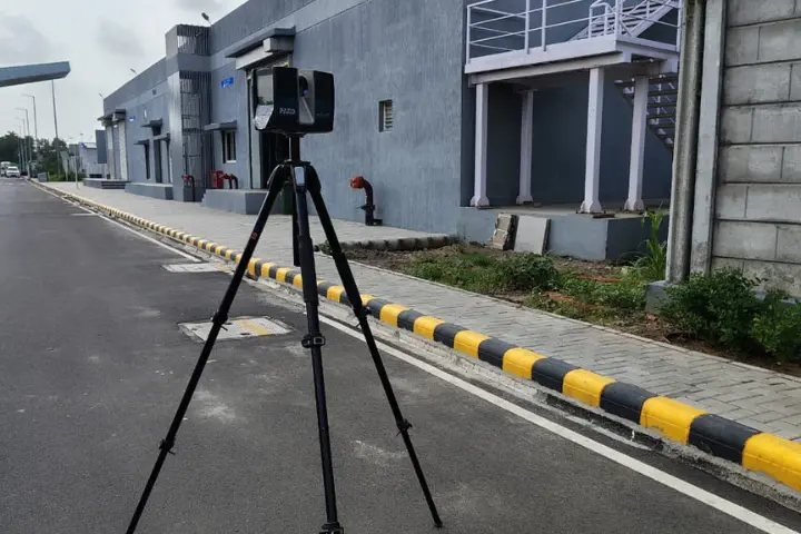
Modern 3D laser scanning equipment can pull in huge amounts of detail quickly, which is why LiDAR shows up so often in:
- 3D laser scanning
- As-built documentation
- Construction surveying
- Scan-to-BIM
- Industrial plant documentation
- Infrastructure mapping
- Reverse engineering
- Heritage documentation
- Digital twin development
Its biggest strength, really, is that it pulls accurate 3D measurements straight from the physical environment — no guesswork involved.
What Is Photogrammetry?
Photogrammetry takes a different route entirely. It builds 3D information out of photographs rather than laser measurements – using a series of overlapping images taken from different angles.
Software then goes through those images, finds points that appear in multiple photos, and uses them to work out the position, shape, and size of objects. From there, you can generate 3D models, point clouds, orthophotos, maps, and other outputs.
You can run photogrammetry with:
- Drones
- Cameras
- UAV systems
- Handheld cameras
- Fixed camera systems
It’s especially handy for large outdoor areas – construction sites, quarries, roads, farmland, infrastructure projects, that sort of thing.
LiDAR vs Photogrammetry: How Are They Different?
At the core, the difference comes down to how each one gathers data.
LiDAR relies on laser measurements. Photogrammetry relies on photographs and image-based calculations.
But it’s not just about the hardware.
LiDAR tends to give you direct, highly accurate distance readings. Photogrammetry, on the other hand, is only as good as the images feeding it quality, camera positioning, lighting, surface texture, and how well the software processes it all matter a lot.
Here’s a closer look at the factors worth weighing.
1. Accuracy
This is usually the first thing people think about when choosing a capture method.
LiDAR is known for delivering highly accurate measurements, which is exactly why it’s the go-to for projects that demand precise geometry – detailed surveys, industrial facilities, construction documentation, engineering work.
That said, photogrammetry can hold its own too, as long as the images are captured properly and the project is well controlled. Camera calibration, image quality, ground control points, flight planning – get those right and accuracy follows.
If your project hinges on dependable dimensional data for engineering or detailed documentation, LiDAR is probably the safer bet.
2. Project Size
Neither technology struggles with scale exactly, but each has its own sweet spot.
Photogrammetry is particularly good at covering large outdoor areas. Send a drone up and it can capture hundreds, even thousands, of images across a big site in a relatively short time.
LiDAR can handle large areas too especially with mobile, aerial, or long-range scanning setups. It really comes down to how much detail you need and what kind of environment you’re working in.
Wide-open topographic areas? Drone photogrammetry tends to work well. Detailed structures or complicated facilities? LiDAR usually pulls ahead.
3. Lighting and Environmental Conditions
Since photogrammetry depends on photographs, lighting can make or break it.
Harsh shadows, dim light, glare, reflections, poor visibility, any of these can throw off the software’s ability to match points across images.
LiDAR doesn’t have that problem in the same way, since it’s not relying on visible light. That’s part of why it works so well indoors, in industrial settings, or anywhere lighting is hard to control.
Still, it’s not completely immune to the environment. Rain, dust, reflective surfaces, and vegetation can all affect scanning performance, depending on the equipment being used.
4. Capturing Complex and Hidden Areas
Another thing to weigh in the LiDAR vs Photogrammetry debate is how each one handles tricky, complex environments.
LiDAR can gather dense 3D data from multiple angles at once, which makes it particularly strong for industrial plants, pipe networks, machinery, and building interiors.
Photogrammetry can also tackle complex objects, but there’s a catch, every surface needs to show up clearly across enough photos for the software to piece it together accurately.
When geometry and spatial detail really matter, LiDAR usually has the edge here.
5. Color and Visual Information
This is where photogrammetry pulls ahead.
Because it’s built from actual photographs, photogrammetry produces genuinely realistic textures and color. That makes it a strong choice for architectural visualization, heritage documentation, inspection work, marketing, or any project where how something looks actually matters.
LiDAR, by contrast, is mainly about geometry. A lot of modern LiDAR systems can add color by pairing scans with photo data, but at its core, LiDAR’s real strength is precise spatial measurement, not visual realism.
Quick Comparison: LiDAR vs Photogrammetry
Factor | LiDAR | Photogrammetry |
|---|---|---|
| Technology | Laser-based | Image-based |
| Accuracy | Very high | High with proper setup |
| Large Areas | Excellent | Excellent |
| Complex Structures | Excellent | Good |
| Lighting Dependence | Low | Higher |
| Color & Texture | Limited / additional imagery needed | Excellent |
| Best For | Detailed 3D measurement | Aerial mapping & visualization |
LiDAR vs Photogrammetry: Which Is More Cost-Effective?
There’s no flat answer here – it really comes down to the project.
Photogrammetry can be the more economical route for certain large-area mapping jobs, especially when drone photography does the job. It covers a lot of ground with fairly accessible equipment.
LiDAR equipment and processing tend to cost more, particularly with advanced professional scanning systems. But cost isn’t just about the price tag on the equipment.
Think about an industrial facility where accurate measurements can head off design errors, rework, or installation headaches down the line. In cases like that, the extra investment in LiDAR can easily pay for itself.
So instead of asking, “Which one’s cheaper?”
A better question is:
“Which technology gives me the accuracy and information I need with the least overall risk to the project?”
When Should You Choose LiDAR?
LiDAR makes sense when your project calls for detailed, accurate 3D measurements.
It’s worth considering when you need:
- High-accuracy 3D documentation
- Detailed as-built information
- Industrial plant scanning
- Scan-to-BIM workflows
- Complex building documentation
- Structural surveys
- Reverse engineering
- Detailed infrastructure capture
- Indoor and outdoor scanning
- Accurate measurements of complex geometry
Say an engineering team needs to document an existing industrial plant before planning modifications. LiDAR can capture the site as it stands and hand over a detailed point cloud to work from during design and engineering.
When Should You Choose Photogrammetry?
Photogrammetry earns its keep when you need to cover large areas efficiently and visual accuracy matters just as much as geometry.
It tends to work well for:
- Large construction sites
- Topographic mapping
- Roads and infrastructure
- Quarries and mines
- Agricultural areas
- Land surveys
- Stockpile measurements
- Aerial mapping
- 3D visualization
- Heritage documentation
Drone photogrammetry is especially useful when walking the entire site would take too long, be too difficult, or simply isn’t safe.
Can LiDAR and Photogrammetry Be Used Together?
Yes, and in a lot of projects, combining them beats relying on just one.
LiDAR brings accurate geometry to the table, while photogrammetry adds high-resolution imagery and color. Put them together and you get a fuller picture.
For instance, a project might use LiDAR to build a precise 3D point cloud, then bring in drone photogrammetry to capture aerial imagery and visual context across the whole site.
Blending the two datasets creates a more complete, more usable representation of the environment.
This combined approach tends to pay off most on large infrastructure projects, industrial facilities, construction documentation, heritage sites, and digital twin work.
LiDAR vs Photogrammetry: Which One Is Best for Your Project?
There’s no single winner in the LiDAR vs Photogrammetry conversation.
It really comes down to what you’re capturing and how you plan to use the data afterward.
Go with LiDAR when measurement accuracy, complex geometry, detailed 3D documentation, and reliable spatial data are your top priorities.
Go with photogrammetry when large-area coverage, aerial mapping, visual detail, and cost-effective capture matter most.
And sometimes, the smartest move isn’t picking one at all – it’s using both.
Final Thoughts
LiDAR and photogrammetry have both become essential tools across surveying, construction, engineering, mapping, and 3D documentation. Knowing what each one does well – and where it struggles – puts you in a much better position before a project even starts.
The right method comes down to your project environment, accuracy requirements, area size, level of detail, deliverables, and budget.
At Fibrox 3D, we help businesses turn real-world environments into accurate digital data using advanced 3D scanning and reality capture solutions. Whether you need detailed 3D laser scanning, LiDAR mapping, Scan-to-BIM, reverse engineering, or digital documentation, choosing the right capture method is the first step toward reliable project results.
Need help deciding between LiDAR and photogrammetry for your project? Contact Fibrox 3D to discuss your requirements and find the right reality capture solution.
FAQs
1. Is LiDAR more accurate than photogrammetry?
LiDAR can provide highly accurate direct distance measurements and is often preferred for projects requiring precise 3D geometry. Photogrammetry can also achieve high accuracy when images, camera calibration, and project controls are properly managed.
2. Is photogrammetry cheaper than LiDAR?
Photogrammetry can be more cost-effective for some large-area mapping projects, but the overall cost depends on project size, equipment, accuracy requirements, processing, and final deliverables.
3. Can LiDAR and photogrammetry be used together?
Yes. Combining LiDAR and photogrammetry can provide accurate 3D geometry along with detailed photographic and color information.
4. Which is better for construction projects?
Both can be useful. LiDAR is often suitable for detailed as-built documentation and Scan-to-BIM, while photogrammetry can be useful for large-area site mapping and aerial documentation.
5. Which technology is better for industrial facilities?
LiDAR is often a strong choice for industrial facilities because it can capture complex structures, machinery, pipelines, and spatial relationships in detailed 3D data.
Also Read: How Revit Family Creation Supports Accurate BIM Modeling