
- Topographic mapping
- Forestry
- Mining
- Infrastructure planning
- Autonomous driving systems
- Lidar is an active remote sensing system. It sends light pulses to understand the shape and distances of objects. Analyzing the timing and intensity of returned signals results in precise 3D mapping.
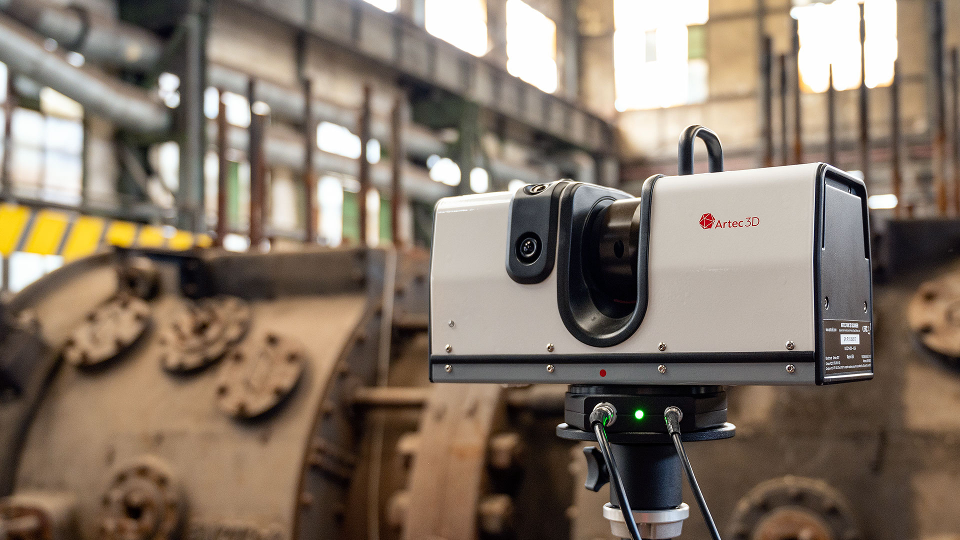
- Laser scanning can be described generally as scanning surfaces with a laser. It is not entirely lidar but includes other categories of scanning such as phase-shift or time-of-flight scanning.
- Precision can be achieved by both technologies, however, a lidar setup designed for larger application space and usually outdoors provides the speed and accuracy in covering a greater area.
- A lidar 3d scanner can create dense point clouds from large terrains in as little as a few minutes.
- Laser scanners provide a very detailed and high-resolution view when applied statically indoors; however, they are limited in range and scope.
- Lidar 3d scanner systems are highly mobile and flexible, as one can mount them on drones, vehicles or airplanes, making it practical to map dangerous or inaccessible areas.
- But laser scanners are generally more static and attached to tripods or hand-held. They are best for scanning buildings, monuments, as well as machines closely.
- Both effectively generate point clouds as an output; however, differences come in the density of point cloud data, the format in which data is collected, and also processing requirements beyond data collection.
- They should include GPS and IMU data to georeferenced the point cloud data, where the output will now be a little more complicated but suitable for geospatial in large scales.
- Laser scanners model detailed models of smaller objects or environments without much concern for geo tagging purposes.
- You go to lidar if you want to make a large landscape model, quickly get the data, and have it all with changing lighting and weather conditions.
- If one intends to scan with extremely high fidelity within a lab-like environment, then a laser scan is the answer.
When discussing mapping and survey, LiDAR vs Laser Scanning can be confused. While both laser technologies gather spatial data, the difference concerning applications, level of accuracy, and working mechanism is quite important. If such a difference between lidar and laser scanning have been raised in your mind, then this blog is for you.
To clarify, the distinction between lidar vs laser scanning is far more than terminology- they are two different technologies performing different functions in different applications. If you're in the industry of urban planning, construction, archaeology, or autonomous vehicles, or otherwise interested, knowing this difference can make a smart technology choice.
What is Lidar?
Light Detection and Ranging refers to a kind of remote-sensing method which determines distance by laser light. Light is emitted in rapid pulses, sometimes at hundreds of thousands of pulses per second, toward the target.
The time it takes for the pulse to travel to the target and back again is then measured by the laser upon receiving the reflected signal. Such measurements, when taken together, help create an accurate three-dimensional model of the surrounding area.
A lidar 3d scanner is mounted to a drone, airplane, or vehicle and has significant applications in industries such as:
A significant advantage of lidar is the way it can collect data under varying conditions, including nighttime and through vegetation.
Key Differences: Lidar vs Laser Scanning
Let's break down the important parameters concerning Lidar vs Laser scanning:
1. Technology and Approach
2. Accuracy and Resolution
3. Mobility and Deployment
4. Data Output
5. Cost and Availability in India
Price is a major factor in a country like India. The lidar 3d scanner is generally pricier because of the advanced sensors and mobility features in it, but with the latest, smaller and more efficient lidar units being sold, prices are gradually coming down.
Laser scanners, especially handheld or tripod-based tend to be relatively cheaper and a lot of use is made of them in Indian architecture and heritage conservation projects.
Real-World Applications in India
Lidar in Indian Projects
India is fast embracing innovative technologies in lidar 3d scanner sectors such as urban development and smart cities and highway planning. The Survey of India has already adopted plant 3d scanning for very high-resolution mapping of river basins and flood-prone areas. The National Highway Authority of India, or NHAI, recently employed lidar in the planning of new roadways and for infrastructure audits.
Drones equipped with lidar 3d scanner units have also been launched for disaster management programs and forest density studies, especially applicable to the region of the Western Ghats and Northeast India.
Laser Scanning in the Indian Context
Laser scanning was a very important technology for restoration of heritage sites, such as, for example the Qutub Minar, the Taj Mahal, and there are many other such important sites in the country like Hampi. Laser scanning has been in use in building information modelling for Indian architectural firms and engineering companies, planning at the level of public works and renovation, safety audits as well.
Laser scanning technology is ganied importance even among manufacturing factories in Pune, Bengaluru, and Chennai for floor space optimization and maintenance workflow efficiency improvement.
Which One Should You Choose?
To sum it all up, the lidar vs laser scanning debate is less about being competitors and even more like a complementary technology debate for both of them. Either one shares an equally significant role in the modern world when it comes to collecting and modeling data, especially as India shifts into becoming a smart infrastructure and digitized spatial data nation.
Conclusion
As India transforms into the digital age in construction, transport, and conservation, understanding difference between lidar and laser scanning. Whether one is a student, GIS professional, or a tech lover, these technologies will help open up new career and innovation avenues.
Demand for lidar 3d scanner solutions is projected to increase with programs like Digital India and Gati Shakti; therefore, expect these instruments to become readily available on the market. However, when it comes to documentation of sites in greater detail or renovation plans, laser scanning has proved to be a strong partner. Also Read About Top Benefits of Reality Capture for BIM Projects