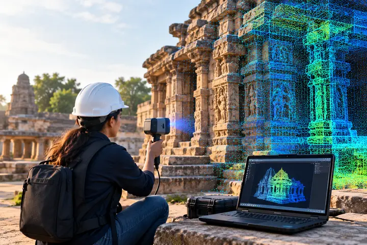
A conservation team needs a reliable record of a building before it can plan a repair. Old measured drawings are often incomplete, hand-drawn or lost, and a monument can change from one monsoon to the next. 3D laser scanning gives teams a measured, non-contact record of what stands today.
For a practical example of this approach, explore our heritage temple 3D scanning project to see how 3D scanning is applied to historic structures.
This guide from Fibrox 3D is written for architects, conservation consultants and site owners who are thinking about commissioning a scan. It explains which capture method suits which part of a heritage site, how a project runs, what you receive at the end, and where scanning reaches its limits.
What Heritage Documentation Needs to Record
Documenting a heritage structure means recording its geometry, its condition and its history. A scan covers the first two well: shape, dimensions, surface relief, deformation and visible damage. It does not record who built the structure, what materials it contains or why a crack appeared. Historians, conservation architects and engineers add that interpretation. The scan gives them an accurate base to work from.
That is why a scan is best treated as one layer of a documentation package, together with photographs, written records and condition surveys.
Choosing the Right Capture Method for Each Part of a Site
No single instrument suits every element of a heritage site. A courtyard wall, a carved bracket and a domed roof each call for something different. Most projects combine methods.
| Method | Best suited to | Things to keep in mind |
|---|---|---|
| Terrestrial laser scanner (time-of-flight or phase-shift) | Façades, interiors, courtyards and overall geometry | Needs several positions to see around obstacles and into recesses |
| Close-range structured-light or triangulation scanner | Carvings, sculptures and small ornamental elements | Short working distance, so it suits details rather than whole buildings |
| Photogrammetry | Colour, texture and orthophoto-style elevations | Gives appearance well, but its geometric accuracy depends on image quality and control |
| Drone surveying | Roofs, domes, tall elevations and the surroundings | Subject to flight permissions and weather |
| Mobile mapping | Streets, long corridors and large linear sites | Best when speed matters more than the finest detail |
Deciding the right mix is part of scoping the project. It is better to agree it with your scanning provider, such as Fibrox 3D, before anyone goes on site.
How a Heritage Scanning Project Runs
- Permissions and brief. Many heritage sites are managed by an authority or trust, so approval to work on site should be arranged early. Agree the purpose of the scan, the areas to cover and the drawings or models you need.
- Reconnaissance and scan plan. The team walks the site to plan scanner positions, check access and identify areas that will be hard to see. Site use, such as visitors or worship, is planned around at this stage.
- Capture. Scans are taken from planned positions, with extra coverage for carvings, recesses and high areas.
- Registration and quality checks. Individual scans are aligned into one point cloud and checked for completeness and accuracy.
- Drawings and models. The point cloud becomes plans, sections, elevations, 3D meshes or BIM models, depending on the brief.
- Archiving. The raw data and the deliverables are stored in formats that others can open in future.
What You Receive
The usual outputs for a heritage project are:
- a registered point cloud, the measured record itself
- plan, section and elevation drawings
- 3D mesh models for detailed surfaces and visualization
- BIM models of the structure, where the project needs them for conservation planning or management
The level of detail you ask for strongly affects the effort involved. A drawing for planning a conservation scheme does not need the same detail as a record of every carved panel. Decide this with your conservation architect before the scan, not after.
Monitoring Change Over Time
A single scan is a snapshot. Repeating the scan later, with the same reference points, lets the team compare the two and see whether the structure has moved or deformed. How small a change can be detected depends on the accuracy of the method and on how consistently the surveys are controlled. A scan shows that something has changed. Understanding why is a job for the conservation engineer.
Two Heritage Projects by Fibrox 3D
These two projects show how the brief shapes the scan.
- A 1.2 km heritage street. We scanned the street and produced as-built elevation drawings to support beautification and conservation planning. Here the deliverable was elevations along a long stretch, so the scope was defined by the drawings needed.
- A hill temple staircase of about 1,000 steps. We scanned the staircase, with buffer areas, and prepared as-built drawings that were used to plan a funicular system. Here the data had to support an engineering design that would be built on the existing structure.
In both cases, the first question was not “which scanner” but “what will the drawings be used for”.
Limits and Challenges
- Permissions and access. Approval, scaffolding, narrow passages and restricted areas all affect what can be captured and when.
- Surface and lighting conditions. Very dark, shiny or wet surfaces can reduce data quality, and a planned scan should allow for them.
- Fine detail needs close-range capture. A scanner that is good for a whole façade may not record small carvings well.
- Data volume. Point clouds are large, so storage, sharing and long-term archiving need planning.
- Interpretation. A scan records what is visible. It does not diagnose structural problems or establish history.
- Cost. It depends on the site size, access, detail and deliverables. Our guide to 3D laser scanning cost explains the drivers.
Where Heritage Documentation Is Heading
Laser scanning and photogrammetry are increasingly used together, so that one record carries both accurate geometry and true colour. Drones make roofs and tall elevations easier to reach. AI-assisted tools are starting to speed up the processing of point clouds, although conservation decisions still need expert judgment. Virtual access also lets people study a site without visiting it, which reduces wear on fragile places.
Conclusion
Good heritage documentation starts with a clear brief and ends with data that people can still use years later. Laser scanning provides the measured geometry. A conservation team provides the interpretation.
Our heritage scanning service covers capture, drawings and models for historic buildings, monuments and streets. If you are planning a documentation or conservation project, talk to us about the scope, and we will suggest a capture plan and the deliverables to ask for.
Frequently Asked Questions
1. How much detail should a heritage scan capture?
It depends on what the record will be used for. Agree the level of detail with your conservation architect before scanning. A conservation plan, a drawing set and a record of ornamental carvings each need different detail.
2. Do I need permission to scan a heritage site?
Protected or managed sites usually require approval from the authority or trust that looks after them. Ask early, because it can affect your schedule.
3. Can scanning replace a conservation architect’s survey?
No. A scan records geometry and visible condition. A conservation architect or engineer interprets the data and decides what to do.
4. How should heritage scan data be archived?
Keep the raw point cloud as well as the drawings and models, in formats that are widely supported, and store copies in more than one place. Record what the data contains and how it was captured.
5. Can interiors with poor lighting be scanned?
Yes. A laser scanner uses its own light, so low ambient light is not a problem. Photographs for colour may need additional lighting.
6. Can a site be scanned while it stays open to visitors?
Often it can, but it needs planning. The scan plan should account for visitor routes, worship and working hours.