
- Precision Mapping: LiDAR helps create high-accuracy elevation models that minimize planning error.
- Infrastructure Monitoring: It helps to monitor the condition of roads, bridges, and buildings, identifying structural weaknesses prior to critical failure.
- Smart City Development: Industrial Laser 3D Mapping aids in Smart City development by creating detailed maps of utilities, roads, and buildings.
- Building Information Modeling (BIM): 3D mapping delivers real data for digital construction models.
- Site Analysis: Before commencing construction, engineers can undertake an assessment of construction sites and minimize the risks.
- Deforestation monitoring: LiDAR is useful for getting accurate measurements of tree canopies, as well as vegetation cover.
- Flood Risk Assessment: Detailed models of the terrain to assess flood-risk areas.
- Wildlife Habitat Mapping: Scientists can observe changes in landscapes and how these changes influence biodiversity.
- Post-disaster Assessment: LiDAR is used to assess damage after earthquakes, hurricanes, and wildfires.
- Search-and-Rescue Operations: 3D models provide in-depth visual layouts of crashed-in structures and uneven terrain.
- High-Resolution Road Mapping: LiDAR allows vehicles to perceive a wide range of distances, identifying obstacles, lane markings, and road signs.
- Improved navigation: Self-driving cars are dependent on 3D maps for real-time decision-making.
- Traffic Management: LiDAR data is used to improve road safety and optimize traffic flow.
- Site Documentation: LiDAR creates detailed maps of ancient ruins and artifacts.
- Detection of Underground Features: Subsurface structures and buried landscapes.
- Preservation Efforts: High-resolution 3D models assist restoration and conservation projects.
- Drone Navigation: 3D mapping techniques enable precise movement of unmanned aerial vehicles (UAVs).
- Infrastructure Security: Department agencies oversee and protect critical facilities.
- Resource Estimation: LiDAR assists in estimating the volume of ore available for extraction.
- Safety Surveillance: It identifies dangerous spots like shaky rock structures.
- Tunnel Mapping: 3d scanning service provider representations are essential for underground mines.
- Soil Analysis: LiDAR calibrates soil quality and moisture levels.
- Irrigation Planning: 3D terrain models assist in planning effective water distribution systems.
- Crop Health Monitoring: Drones with LiDAR identify differences in plant growth.
- LiDAR Smooth & Realistic Game Environments: You can scan real-world locations to recreate more accurate virtual environments.
- AR Application Development: AR experiences are greatly improved with object recognition capabilities provided by LiDAR.
Introduction:
The technology uses laser pulses to measure distances and create highly detailed 3D digital representations of physical spaces. Laser 3D mapping is used in a variety of sectors, including construction, urban planning, environmental monitoring, and self-driving cars.
This blog will highlight some of the primary 3D laser mapping experts in various industries and for professionals that require this technology for increased accuracy and efficiency while enhancing safety.
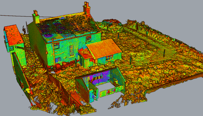
1. Urban Planners and Civil Engineers
One of the largest beneficiaries of 3D laser mapping is urban planners and civil engineers. They use this technology to create highly detailed topographical maps, assess needs for infrastructure, and plan new developments with precision.
Benefits:
With LiDAR technology, urban planners can efficiently design sustainable cities, optimize traffic flow, and enhance disaster preparedness.
2. Construction and Architecture Professionals
Laser 3D mapping is used by construction companies and architects to increase project design, planning, and execution efficiency.
Benefits:
3. Environmental Scientists and Specialists, Including Health
Laser 3D mapping also helps scientists study ecosystems, forests, and coastal areas, allowing them to monitor the environment.
Benefits:
The benefits of laser 3D mapping equip conservationists with insight to make critical decisions surrounding land preservation, climate change adaptation, and disaster response strategy.
4. Disaster Management and Emergency Response Teams
Disaster preparedness and response from laser 3D mapping are the strengths of first responders and disaster management agencies.
Benefits:
With laser 3D mapping, emergency response teams can react more swiftly and with greater clarity, potentially saving lives and stemming property damage.
5. Autonomous Vehicle and Transportation Industry
Laser 3D mapping is highly beneficial for the transportation industry, such as self-driving car companies.
Benefits:
LiDAR-based 3D maps will be essential for a vehicle's safety and efficiency as self-driving technology continues to advance.
6. Archaeologists and Cultural Heritage Preservation Experts
Industrial laser 3D mapping can be used to investigate archaeological sites without damaging delicate structures.
Benefits:
Using LiDAR, archaeologists are able to explore historical sites in ways never possible and preserve cultural heritage for future generations.
7. Military and Defense Sector
The military takes advantage of laser 3D mapping by the surveillance, reconnaissance, and mission planning.
Benefits:
Laser 3D mapping provides situational awareness, enabling military personnel to operate with increased precision and safety.
8. Mining and Geological Exploration
3D laser mapping helps mining companies and geologists estimate mineral deposits and streamline excavation.
Benefits:
LiDAR allows mining companies to minimize their impact on the environment and their workers while maximizing resource extraction.
9. Agriculture and Precision Farming
Laser 3D mapping is also used by farmers and agronomists to improve crop production and land management.
Benefits:
Efficiency in agriculture increases under precision farming approaches, which also leads to decreased use of pesticides and water.
10. Entertainment and Virtual Reality (VR) Industry
Moreover, industrial laser 3D mapping is also ideal for the entertainment industry, such as gaming and virtual reality developers, as it helps create seamless and immersive digital experiences.
Benefits:
Laser 3D mapping is becoming common in digital entertainment, where creators make realistic and engaging 3D visuals.
Conclusion
Benefits of laser 3D mapping have begun to use laser 3D mapping technology that allows for an unparalleled level of accuracy, efficiency, and safety. The potential use cases for this technology are great and diverse, from urban planners and construction workers to autonomous vehicle makers and archaeologists.
As LiDAR evolves, further domains will utilize laser 3D mapping, continuing to reshape our interaction with the world around us. With advancements in machine learning and artificial intelligence, a promising future awaits laser 3D mapping. Also Read About Drone Lidar Surveys