
- Terrain Mapping in Dense Vegetation: Traditional aerial photography is not effective when it comes to acquiring ground elevations in forests or thick vegetation. Unlike other methods of measurement, LiDAR can penetrate tree canopies, allowing it to capture the actual terrain underneath.
- Improved Elevation Models: Digital elevation models (DEMs) created through LiDAR provide accurate topographical information, which is paramount for land development and flood risk assessment.
- Wide Area Coverage: Drones can cover hundreds of hectares in one flight; traditional surveys may take weeks or months.
- Automated Flight Paths: A pre-programmed flight path allows the UAS to capture data in a systematic manner with minimal human intervention.
- Steep cliffs and abnormal ground
- Wildlife hazards in dense forests
- Areas affected by natural disasters (landslides, floods)
- Reduced Manpower: The need for fewer field surveyors reduces manpower costs.
- Decreased Equipment Expenses: Drones remove the necessity for costly ground-based LiDAR scanners and manned aircraft surveys.
- Reduced Reworking: First-time accurate mapping prevents the need to survey more than once, thereby saving time and money.
- Roads and Urban Areas: Topological mapping of the infrastructure.
- Forests: Measuring the density of trees, height of the canopy, and land topography.
- Coastal Zones: Monitoring erosion, shoreline changes, and flood-prone areas.
- Road and highway planning: Accurate elevation data provides help in designing proper road networks, along with drainage.
- Utility Mapping: This LiDAR technology includes high-resolution 3D mapping capabilities.
- Construction site surveys: Construction companies, using LiDAR-generated models, typically use LiDAR to track progress and verify the work matches design plans.
- 3D laser scanning technology is essential for environmental scientists, who need to study changes in the land and the health of ecosystems.
- LiDAR and Deforestation Analysis would detect the loss of forest cover, which can tell them what the reforestation plan should be.
- Long-term complex coastal erosion studies Monitoring of coastal erosion, including shorelines and sand dunes, guides effective coastal protection plans.
- Soil Erosion Monitoring:Detects soil loss hotspots and provides recommendations for mitigation.
- Irrigation Planning:Based on the analysis of the area, identify the best ways to distribute water.
- Crop Health Assessment:Detects variations in plant height and density to improve yield prediction.
- Volume Calculation: Drone Mapping Services calculates the volume of extracted materials in quarries.
- Slope Stability Analysis: Evaluates the stability of slopes in open-pit mines to determine the potential for landslides.
- Flood Mapping: Helps in identifying areas prone to flooding and developing an emergency response plan.
- Landslide Prediction: Identify unstable slopes before they collapse.
- AI-Powered Data Analysis: Machine learning algorithms will be used to improve terrain classification and feature extraction.
- Miniaturized LiDAR Sensors: Smaller sensors will enable drones to be more efficient and less expensive.
- Integration with 5G Networks: 5G networks will provide higher data transmission speeds, enabling real-time mapping applications.
Introduction:
Land mapping plays significant roles in urban planning, construction, environmental monitoring, and infrastructure development. Ground-based total station surveying or utilizing satellite imagery can be less accurate, less economical, or not accessible to all parties.
Read on about how drone LiDAR surveys shape the future of land mapping, the benefits of the technology, its applications, and its impact on industries that depend on precise terrain information.
Advantages of Drone LiDAR Surveys for Land Mapping
High Accuracy and Precision
One of the greatest benefits of drone LiDAR surveys is that they can collect very precise elevation data. Photogrammetry depends on visual images of the terrain to make the model; LiDAR watches the vegetation and gives accurate ground height, which gives LiDAR an edge.
Faster Data Collection
Compared to ground surveys, drone LiDAR surveys are faster for land mapping.
3D laser scanning technology is particularly useful for large-scale projects, including infrastructure development, agricultural assessments, and environmental studies.
Enhanced Safety for Surveyors
Surveyors face dangers when they map the land in dangerous or remote locations. Drone LiDAR removes the necessity for people to literally walk the land, which can lessen the risk of hazards like:
Surveyors can safely perform land assessments from a distance by using drones.
Cost-Effective Land Mapping
Drone-based LiDAR has made it cost-effective to conduct high-resolution land mapping, making it more affordable than ever to integrate into land planning processes.
Adaptability in Different Conditions of Terrain
Drone LiDAR surveys can be performed in various environments, which include:
These capabilities make drone LiDAR the best choice for a number of different use cases.
Applications of Drone LiDAR in Land Mapping
1. Urban Planning and Infrastructure Development
Urban mapping, land suitability analyses, and infrastructure design for city planners and engineers utilize drone LiDAR surveys.
2. Environmental Monitoring and Conservation
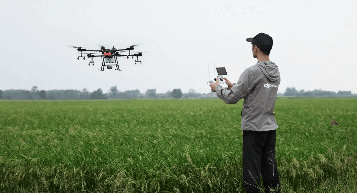
3. Agriculture and Precision Farming
Drone LiDAR serves farmers and agronomists in optimizing land and enabling better crop production.
4. Mining and Geology Surveys
Mining operations save LiDAR survey time and money with drone use (LiDAR).
5. Disaster Management and Risk Assessment
Drone LiDAR is critical in disaster response and mitigation planning.
The Future of Drone LiDAR in Land Mapping
With advancements in technology, drone Lidar surveys are evolving, offering enhancements that include:
With automation, precision, and real-time data processing being the way forward in land mapping, drone LiDAR has become an essential toolkit for many land management professionals across various industries.
Conclusion
A LiDAR mapping service is an accurate, efficient, and cost-effective solution for mapping land. The ability to penetrate foliage, capture high-resolution elevation data, and quickly cover large areas makes this technology extremely valuable for urban planning, agriculture, mining, environmental monitoring, and disaster management.
Drone technology is also evolving, and with it, LiDAR-based mapping becomes even more powerful, setting a new standard for the future of land surveying and geographic analysis. also read about Why LiDAR is Vital for Smart Cities