
- Total Stations and Theodolites: Though these instruments offer precise distance and angle measurements, they demand manual operation and substantial setup.
- GPS Surveying: An accurate method but requires costly equipment and trained professionals.
- Aerial Surveying via Manned Aircraft: The most common type of aerial mapping for small and medium projects, UAVs provide high spatial resolution with high accuracy.
- Surveying level measuring tapes and level manual: This drone mapping service takes a lot of time and is prone to human error.
- Pre-Survey Planning: Defining the survey area, flight paths, and altitude/resolution requirements.
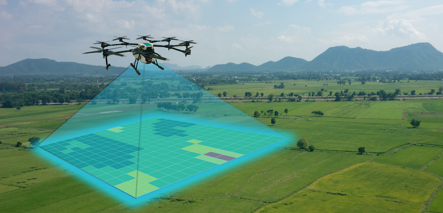
- Data Collection: Over the specific land space, drones fly to get high-res images as well as LiDAR scans.
- Data Processing: Data collected are assembled into high-resolution 3D models, orthomosaics, and elevation in custom software.
- Analysis and Interpretation: The processed data is then geo-located and tagged to produce 2D or 3D maps of structures or environments.
Introduction:
It is a very relevant process for the agriculture, construction, and real estate industries, as well as environmental management. Land surveying has most commonly been done with very ground-intensive methods, which required a lot of investment in terms of time, manpower, and finance.
But the recent technological advancements have brought in drones, which are a quick, efficient, and cheaper alternative to land measurement. They are providing high-precision, fast, and low-cost drone survey solutions. This blog explores how drone technology is transforming land measurement, highlighting its cost-effective solution for land measurement, efficiency, and practical applications.
Traditional Land Survey Methods and Their Challenges
Land mapping used to depend only on classic technologies prior to the drone:
These approaches are often extremely time-, labor-, and capital-intensive. Atmospheric and soil stability conditions challenge standard surveying methods. Drone technology is addressing many of these limitations.
How Drone Surveys Work
Drone surveying uses unmanned aerial vehicles (UAVs) with integrated high-resolution cameras, GPS, and lidar 3d scanner
They collect aerial imagery and data points, which are then processed by the licensed professionals with Geographic Information System (GIS) software and photogrammetry techniques to produce accurate 3D maps, topographical surveys, and land models.
The process typically involves the following steps:
Cost-Effectiveness of Drone Surveys for Land Measurement
Reduced Labor and Time Costs
Conventional land surveys need several staff for days or weeks, depending upon the size of the project. On the other hand, a cost-effective solution for land measurement can cover large areas in hours, which significantly lowers labor costs. Using drones, a survey that takes a week with traditional methods can now take a day.
The cost of equipment and operation is lower
The conventional way of surveying involves high-cost equipment like GPS units, total stations, and aircraft for aerial surveys. Drones, in contrast, are less expensive and carry out the same work with minimal equipment costs. Moreover, drone operations are less labor-intensive than traditional operations.
High Accuracy at a Lower Price
Drones are able to take with very little error (up to survey-grade accuracy) surveying and mapping, thus reducing repeat measurements. More advanced sensors, such as RTK (Real-Time Kinematic) GPS and LiDAR, increase accuracy, making sure that you are getting the same accurate land information at a cost less than conventional surveying.
Accessibility and Safety
Drones are easy to access in difficult terrain like mountains, dense forests, and hazardous sites without putting humans at risk. This will save on prohibitively expensive safety equipment and staff, reducing costs further.
Minimized Site Disruptions
drone mapping services often necessitate that land be accessed physically, which can impair things such as construction or farming. This is where drones come to the rescue by surveying from the air, reducing downtime, and increasing productivity.
Applications of Drone Surveys in Land Measurement
1. Construction and Infrastructure Development
Drones are used to provide detailed topographic maps and site surveys for construction projects to ensure accurate planning and progress tracking.
They assist in volume calculations, earthwork estimations, and construction site monitoring, minimizing errors and project delays.
2. Agriculture and Land Management
Drone surveys are often used by farmers and agriculture companies to monitor the health of crops, evaluate irrigation requirements, and obtain field boundary maps. This aids precision farming, resource management, optimizing land usage, and productivity while reducing costs.
3. Real Estate and Property Development
Real estate developers and property managers make use of drones to form high-resolution land maps to help with site selection, boundary identification, and property valuation.
Aerial imagery provides potential buyers with a comprehensive view of the property, enhancing marketing efforts significantly.
4. Environmental and Disaster Management
For environmental monitoring, monitoring deforestation and the mapping of flood-prone areas and damage assessment of natural disasters. Cost-Effective Solution for Land Measurement helps plan responses to disasters, reduce risks, and allocate resources efficiently.
5. Mining and Quarrying
Drone surveys help mining companies monitor excavation sites, measure stockpile volumes, and verify compliance with safety regulations. This minimizes surveying costs and enhances operational efficiency.
Conclusion
From the discovery of cost-effective ways to measure land, drone surveys have quickly become the new gold, saving time and money while delivering the highest levels of quality available anywhere. With the advancements in technology, the use of drone mapping services will gain even more potential in measuring lands, as it can be beneficial for various fields, including construction, agriculture, real estate, and environmental management. Also Read About Top 5 Major Advantages of LiDAR Laser.